

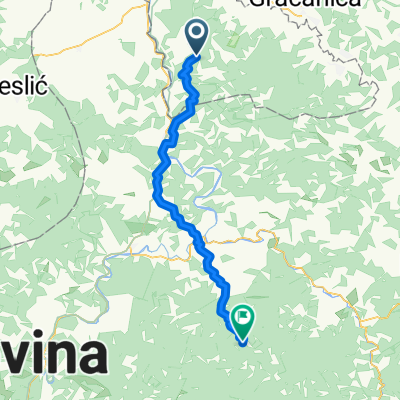
M 110, Doboj-Jug to M 110, Doboj-Jug
A cycling route starting in Tešanjka, Federation of Bosnia and Herzegovina, Bosnia and Herzegovina.
Overview
About this route
- 1 h 24 min
- Duration
- 11 km
- Distance
- 227 m
- Ascent
- 201 m
- Descent
- 7.9 km/h
- Avg. speed
- 333 m
- Max. altitude
Route quality
Waytypes & surfaces along the route
Waytypes
Quiet road
7.8 km
(71 %)
Access road
0.2 km
(2 %)
Undefined
3 km
(27 %)
Surfaces
Paved
4 km
(36 %)
Asphalt
4 km
(36 %)
Undefined
7 km
(64 %)
Continue with Bikemap
Use, edit, or download this cycling route
You would like to ride M 110, Doboj-Jug to M 110, Doboj-Jug or customize it for your own trip? Here is what you can do with this Bikemap route:
Free features
- Save this route as favorite or in collections
- Copy & plan your own version of this route
- Sync your route with Garmin or Wahoo
Premium features
Free trial for 3 days, or one-time payment. More about Bikemap Premium.
- Navigate this route on iOS & Android
- Export a GPX / KML file of this route
- Create your custom printout (try it for free)
- Download this route for offline navigation
Discover more Premium features.
Get Bikemap PremiumFrom our community
Other popular routes starting in Tešanjka
 23. Tag: Makljenovac (Doboj) - Vinkovci
- Distance
- 121 km
- Ascent
- 65 m
- Descent
- 137 m
- Location
- Tešanjka, Federation of Bosnia and Herzegovina, Bosnia and Herzegovina
 Steady ride in
- Distance
- 20.7 km
- Ascent
- 302 m
- Descent
- 302 m
- Location
- Tešanjka, Federation of Bosnia and Herzegovina, Bosnia and Herzegovina
 stanari
- Distance
- 54.6 km
- Ascent
- 2,357 m
- Descent
- 2,353 m
- Location
- Tešanjka, Federation of Bosnia and Herzegovina, Bosnia and Herzegovina
 M 110, Doboj-Jug to M 110, Doboj-Jug
- Distance
- 22.9 km
- Ascent
- 350 m
- Descent
- 356 m
- Location
- Tešanjka, Federation of Bosnia and Herzegovina, Bosnia and Herzegovina
 Doboj-Jug to M4, Doboj-Jug
- Distance
- 8 km
- Ascent
- 8 m
- Descent
- 185 m
- Location
- Tešanjka, Federation of Bosnia and Herzegovina, Bosnia and Herzegovina
 josip
josip- Distance
- 4.6 km
- Ascent
- 130 m
- Descent
- 8 m
- Location
- Tešanjka, Federation of Bosnia and Herzegovina, Bosnia and Herzegovina
 Tešanjka - Gostovići
- Distance
- 54.8 km
- Ascent
- 1,922 m
- Descent
- 2,000 m
- Location
- Tešanjka, Federation of Bosnia and Herzegovina, Bosnia and Herzegovina
 Slow ride in
- Distance
- 9.7 km
- Ascent
- 121 m
- Descent
- 149 m
- Location
- Tešanjka, Federation of Bosnia and Herzegovina, Bosnia and Herzegovina
Open it in the app