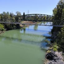
Čepulje - Sv. Ožbolt
A cycling route starting in Zgornje Bitnje, Kranj, Slovenia.
Overview
About this route
Čepulje - Sveti Križ - Sveti Tomaž - Lubnik - Sveti Ožbolt - Sveti Petra Hrib
- -:--
- Duration
- 46.3 km
- Distance
- 1,675 m
- Ascent
- 1,746 m
- Descent
- ---
- Avg. speed
- 878 m
- Avg. speed
Route quality
Waytypes & surfaces along the route
Waytypes
Quiet road
32.2 km
(70 %)
Track
8.2 km
(18 %)
Surfaces
Paved
30.9 km
(67 %)
Unpaved
8.3 km
(18 %)
Asphalt
25.8 km
(56 %)
Paved (undefined)
5 km
(11 %)
Continue with Bikemap
Use, edit, or download this cycling route
You would like to ride Čepulje - Sv. Ožbolt or customize it for your own trip? Here is what you can do with this Bikemap route:
Free features
- Save this route as favorite or in collections
- Copy & plan your own version of this route
- Sync your route with Garmin or Wahoo
Premium features
Free trial for 3 days, or one-time payment. More about Bikemap Premium.
- Navigate this route on iOS & Android
- Export a GPX / KML file of this route
- Create your custom printout (try it for free)
- Download this route for offline navigation
Discover more Premium features.
Get Bikemap PremiumFrom our community
Other popular routes starting in Zgornje Bitnje
- Spodnje Bitnje - Vršič - Mangartsko sedlo - Spodnje Bitnje
- Distance
- 283.1 km
- Ascent
- 3,510 m
- Descent
- 3,510 m
- Location
- Zgornje Bitnje, Kranj, Slovenia
- žabnica-križna-jošt-žabnica
- Distance
- 24.6 km
- Ascent
- 741 m
- Descent
- 738 m
- Location
- Zgornje Bitnje, Kranj, Slovenia
- 1.vožnja cez polje
- Distance
- 8.8 km
- Ascent
- 12 m
- Descent
- 12 m
- Location
- Zgornje Bitnje, Kranj, Slovenia
- JavornikZbiljeJavornik
- Distance
- 55 km
- Ascent
- 420 m
- Descent
- 420 m
- Location
- Zgornje Bitnje, Kranj, Slovenia
- Čeplje - Rovtarica
- Distance
- 43.3 km
- Ascent
- 1,387 m
- Descent
- 1,622 m
- Location
- Zgornje Bitnje, Kranj, Slovenia
- Škofjeloško, Polhograjci
- Distance
- 155.5 km
- Ascent
- 2,829 m
- Descent
- 2,830 m
- Location
- Zgornje Bitnje, Kranj, Slovenia
- čepulje- križna
- Distance
- 23.1 km
- Ascent
- 511 m
- Descent
- 510 m
- Location
- Zgornje Bitnje, Kranj, Slovenia
- Spodnje Bitnje - Bled - Doslovče - Spodnje Bitnje
- Distance
- 88 km
- Ascent
- 891 m
- Descent
- 891 m
- Location
- Zgornje Bitnje, Kranj, Slovenia