

Andechs
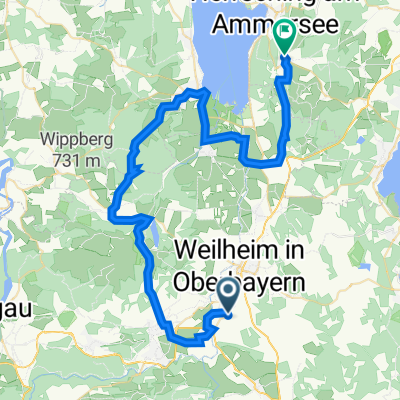
A2 Polling-Hohenpeißenberg-Wessobrunn-Dießen-Andechs 67,2km 670hm
A cycling route starting in Polling, Bavaria, Germany.
Overview
About this route
- -:--
- Duration
- 67.2 km
- Distance
- 881 m
- Ascent
- 776 m
- Descent
- ---
- Avg. speed
- 779 m
- Max. altitude

Part of
Andechs
16 stages
Route quality
Waytypes & surfaces along the route
Waytypes
Track
35.6 km
(53 %)
Quiet road
18.1 km
(27 %)
Surfaces
Paved
33.6 km
(50 %)
Unpaved
30.2 km
(45 %)
Asphalt
31.6 km
(47 %)
Gravel
20.8 km
(31 %)
Continue with Bikemap
Use, edit, or download this cycling route
You would like to ride A2 Polling-Hohenpeißenberg-Wessobrunn-Dießen-Andechs 67,2km 670hm or customize it for your own trip? Here is what you can do with this Bikemap route:
Free features
- Save this route as favorite or in collections
- Copy & plan your own version of this route
- Sync your route with Garmin or Wahoo
Premium features
Free trial for 3 days, or one-time payment. More about Bikemap Premium.
- Navigate this route on iOS & Android
- Export a GPX / KML file of this route
- Create your custom printout (try it for free)
- Download this route for offline navigation
Discover more Premium features.
Get Bikemap PremiumFrom our community
Other popular routes starting in Polling
 Weilheim Staffelsee
- Distance
- 49.6 km
- Ascent
- 293 m
- Descent
- 294 m
- Location
- Polling, Bavaria, Germany
 Oderding - Uffing - Rottenbuch - Peiting - Paterzell
- Distance
- 68.5 km
- Ascent
- 642 m
- Descent
- 642 m
- Location
- Polling, Bavaria, Germany
 A2b Polling-Berghof-Peißenberg-Wessobrunn-Dießen-Andechs 51,5km 570hm
- Distance
- 51.5 km
- Ascent
- 689 m
- Descent
- 584 m
- Location
- Polling, Bavaria, Germany
 Polling - Bromberg
- Distance
- 37.7 km
- Ascent
- 283 m
- Descent
- 281 m
- Location
- Polling, Bavaria, Germany
 Starnberger See - Andechs
- Distance
- 90.7 km
- Ascent
- 347 m
- Descent
- 364 m
- Location
- Polling, Bavaria, Germany
 Hettenrunde
- Distance
- 37.3 km
- Ascent
- 484 m
- Descent
- 485 m
- Location
- Polling, Bavaria, Germany
 Weilheim Feldafing
- Distance
- 22.7 km
- Ascent
- 167 m
- Descent
- 112 m
- Location
- Polling, Bavaria, Germany
 Zwischen Ammersee und Starnberger See-RR60
- Distance
- 59.3 km
- Ascent
- 324 m
- Descent
- 323 m
- Location
- Polling, Bavaria, Germany
Open it in the app