

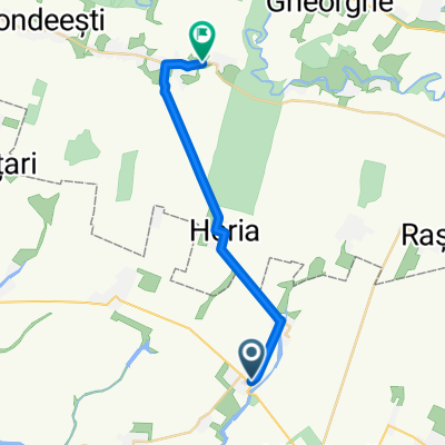
Lehliu - Oltenita
A cycling route starting in Lehliu, Călărași County, Romania.
Overview
About this route
- -:--
- Duration
- 70.8 km
- Distance
- 208 m
- Ascent
- 247 m
- Descent
- ---
- Avg. speed
- 56 m
- Max. altitude

Route quality
Waytypes & surfaces along the route
Waytypes
Quiet road
17.7 km
(25 %)
Road
7.8 km
(11 %)
Surfaces
Paved
54.5 km
(77 %)
Unpaved
2.8 km
(4 %)
Asphalt
54.5 km
(77 %)
Gravel
2.1 km
(3 %)
Continue with Bikemap
Use, edit, or download this cycling route
You would like to ride Lehliu - Oltenita or customize it for your own trip? Here is what you can do with this Bikemap route:
Free features
- Save this route as favorite or in collections
- Copy & plan your own version of this route
- Sync your route with Garmin or Wahoo
Premium features
Free trial for 3 days, or one-time payment. More about Bikemap Premium.
- Navigate this route on iOS & Android
- Export a GPX / KML file of this route
- Create your custom printout (try it for free)
- Download this route for offline navigation
Discover more Premium features.
Get Bikemap PremiumFrom our community
Other popular routes starting in Lehliu
 For Saturday
- Distance
- 86.8 km
- Ascent
- 125 m
- Descent
- 126 m
- Location
- Lehliu, Călărași County, Romania
 La tara la Corina
- Distance
- 70.4 km
- Ascent
- 83 m
- Descent
- 80 m
- Location
- Lehliu, Călărași County, Romania
 Strada 22, Lehliu to Strada Principală, Axintele
- Distance
- 19.6 km
- Ascent
- 93 m
- Descent
- 114 m
- Location
- Lehliu, Călărași County, Romania
 DJ305 505, Lehliu to Strada Eroilor
- Distance
- 59.3 km
- Ascent
- 274 m
- Descent
- 315 m
- Location
- Lehliu, Călărași County, Romania
 Lehliu - Oltenita
- Distance
- 70.8 km
- Ascent
- 208 m
- Descent
- 247 m
- Location
- Lehliu, Călărași County, Romania
 test
test- Distance
- 4.8 km
- Ascent
- 6 m
- Descent
- 5 m
- Location
- Lehliu, Călărași County, Romania
 Lehliu - Sapunari - DJ201B si retur prin Lehliu Gara
- Distance
- 19.1 km
- Ascent
- 28 m
- Descent
- 30 m
- Location
- Lehliu, Călărași County, Romania
Open it in the app