

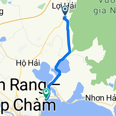
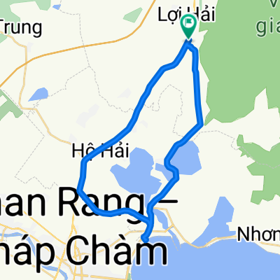
23-1.027.00_
A cycling route starting in Khánh Hải, Ninh Thuận Province, Vietnam.
Overview
About this route
- -:--
- Duration
- 95.6 km
- Distance
- 1,035 m
- Ascent
- 1,027 m
- Descent
- ---
- Avg. speed
- 201 m
- Max. altitude

Route quality
Waytypes & surfaces along the route
Waytypes
Quiet road
25.8 km
(27 %)
Cycleway
8.6 km
(9 %)
Surfaces
Paved
34.4 km
(36 %)
Unpaved
1 km
(1 %)
Asphalt
34.4 km
(36 %)
Unpaved (undefined)
1 km
(1 %)
Undefined
60.2 km
(63 %)
Continue with Bikemap
Use, edit, or download this cycling route
You would like to ride 23-1.027.00_ or customize it for your own trip? Here is what you can do with this Bikemap route:
Free features
- Save this route as favorite or in collections
- Copy & plan your own version of this route
- Split it into stages to create a multi-day tour
- Sync your route with Garmin or Wahoo
Premium features
Free trial for 3 days, or one-time payment. More about Bikemap Premium.
- Navigate this route on iOS & Android
- Export a GPX / KML file of this route
- Create your custom printout (try it for free)
- Download this route for offline navigation
Discover more Premium features.
Get Bikemap PremiumFrom our community
Other popular routes starting in Khánh Hải
 23-1.027.00_
- Distance
- 95.6 km
- Ascent
- 1,035 m
- Descent
- 1,027 m
- Location
- Khánh Hải, Ninh Thuận Province, Vietnam
 Ninh Chữ - Song Luy
- Distance
- 105.5 km
- Ascent
- 182 m
- Descent
- 160 m
- Location
- Khánh Hải, Ninh Thuận Province, Vietnam
 Yên Ninh, Phan Rang-Thap Cham to Ninh Hai
- Distance
- 6.3 km
- Ascent
- 21 m
- Descent
- 34 m
- Location
- Khánh Hải, Ninh Thuận Province, Vietnam
 J17 — Dimanche 21 janvier 2018 – Ho Hai – Nha Trang
- Distance
- 93.7 km
- Ascent
- 238 m
- Descent
- 229 m
- Location
- Khánh Hải, Ninh Thuận Province, Vietnam
 Blistering ride
- Distance
- 15.8 km
- Ascent
- 27 m
- Descent
- 46 m
- Location
- Khánh Hải, Ninh Thuận Province, Vietnam
 Thap cham - Mui Ne
- Distance
- 131.4 km
- Ascent
- 324 m
- Descent
- 293 m
- Location
- Khánh Hải, Ninh Thuận Province, Vietnam
 Fast ride
- Distance
- 35.5 km
- Ascent
- 56 m
- Descent
- 66 m
- Location
- Khánh Hải, Ninh Thuận Province, Vietnam
Open it in the app