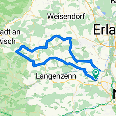
Fürther-Stadtwald Audauer-/Techniktraining
A cycling route starting in Seukendorf, Bavaria, Germany.
Overview
About this route
Die Strecke ist relativ lang und hat einige nette Anstiege. Verwendet wird diese für vorwiegend für Techniktraining und um nicht aus der Fitness zu kommen sind einige Waldautobahnen zu den m.E. besten Trails im Fürther Stadtwald.
- -:--
- Duration
- 24.2 km
- Distance
- 339 m
- Ascent
- 340 m
- Descent
- ---
- Avg. speed
- ---
- Avg. speed
Continue with Bikemap
Use, edit, or download this cycling route
You would like to ride Fürther-Stadtwald Audauer-/Techniktraining or customize it for your own trip? Here is what you can do with this Bikemap route:
Free features
- Save this route as favorite or in collections
- Copy & plan your own version of this route
- Sync your route with Garmin or Wahoo
Premium features
Free trial for 3 days, or one-time payment. More about Bikemap Premium.
- Navigate this route on iOS & Android
- Export a GPX / KML file of this route
- Create your custom printout (try it for free)
- Download this route for offline navigation
Discover more Premium features.
Get Bikemap PremiumFrom our community
Other popular routes starting in Seukendorf
- 1 Rund - 76km
- Distance
- 73.2 km
- Ascent
- 389 m
- Descent
- 388 m
- Location
- Seukendorf, Bavaria, Germany
- burgfarrnbach rennhofen und zurück
- Distance
- 56.9 km
- Ascent
- 483 m
- Descent
- 460 m
- Location
- Seukendorf, Bavaria, Germany
- Rundtour Burgfarrnbach - Hagenbüchach
- Distance
- 35.9 km
- Ascent
- 224 m
- Descent
- 221 m
- Location
- Seukendorf, Bavaria, Germany
- Gerade Fahrt in Cadolzburg
- Distance
- 20.2 km
- Ascent
- 103 m
- Descent
- 100 m
- Location
- Seukendorf, Bavaria, Germany
- Fürther-Stadtwald Audauer-/Techniktraining
- Distance
- 24.2 km
- Ascent
- 339 m
- Descent
- 340 m
- Location
- Seukendorf, Bavaria, Germany
- Obermichelbach-Dürrnbuch-Langenzenn
- Distance
- 55.5 km
- Ascent
- 269 m
- Descent
- 269 m
- Location
- Seukendorf, Bavaria, Germany
- Training Gelände bisschen Ausdauer
- Distance
- 11.1 km
- Ascent
- 111 m
- Descent
- 113 m
- Location
- Seukendorf, Bavaria, Germany
- Rundweg - David
- Distance
- 68.4 km
- Ascent
- 283 m
- Descent
- 283 m
- Location
- Seukendorf, Bavaria, Germany
Open it in the app