

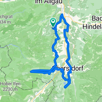
Tracking_Rangiswanger_Ofterswanger_Horn
A cycling route starting in Ofterschwang, Bavaria, Germany.
Overview
About this route
Tracking_Rangiswanger_Ofterswanger_Horn
- -:--
- Duration
- 11.7 km
- Distance
- 694 m
- Ascent
- 693 m
- Descent
- ---
- Avg. speed
- 1,599 m
- Max. altitude
Continue with Bikemap
Use, edit, or download this cycling route
You would like to ride Tracking_Rangiswanger_Ofterswanger_Horn or customize it for your own trip? Here is what you can do with this Bikemap route:
Free features
- Save this route as favorite or in collections
- Copy & plan your own version of this route
- Sync your route with Garmin or Wahoo
Premium features
Free trial for 3 days, or one-time payment. More about Bikemap Premium.
- Navigate this route on iOS & Android
- Export a GPX / KML file of this route
- Create your custom printout (try it for free)
- Download this route for offline navigation
Discover more Premium features.
Get Bikemap PremiumFrom our community
Other popular routes starting in Ofterschwang
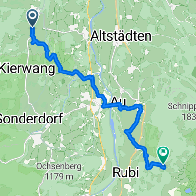 OA5 nach Gaisalpe
- Distance
- 13.5 km
- Ascent
- 494 m
- Descent
- 216 m
- Location
- Ofterschwang, Bavaria, Germany
 Von Ofterschwang zur Alpe Altstädter Hof
- Distance
- 26.8 km
- Ascent
- 670 m
- Descent
- 670 m
- Location
- Ofterschwang, Bavaria, Germany
 Route in Ofterschwang
- Distance
- 61.1 km
- Ascent
- 1,258 m
- Descent
- 1,257 m
- Location
- Ofterschwang, Bavaria, Germany
 Ofterschwang zur Alpe Sonthofener Hof
- Distance
- 20.6 km
- Ascent
- 565 m
- Descent
- 566 m
- Location
- Ofterschwang, Bavaria, Germany
 Illertal runde, mit 3 steigungen
- Distance
- 38.2 km
- Ascent
- 430 m
- Descent
- 474 m
- Location
- Ofterschwang, Bavaria, Germany
 Gunzesried - Bärenköpfle - Mittag - Gschwender Horn - Alpsee - Immenstadt - Gunzesried CLONED FROM ROUTE 84082
- Distance
- 36.4 km
- Ascent
- 1,318 m
- Descent
- 1,309 m
- Location
- Ofterschwang, Bavaria, Germany
 OBERSTDORF RUNDE RR
- Distance
- 42.5 km
- Ascent
- 393 m
- Descent
- 392 m
- Location
- Ofterschwang, Bavaria, Germany
 6-1) Stillacherstr. - Illerdamm (Rundweg)
- Distance
- 28.4 km
- Ascent
- 347 m
- Descent
- 345 m
- Location
- Ofterschwang, Bavaria, Germany
Open it in the app