

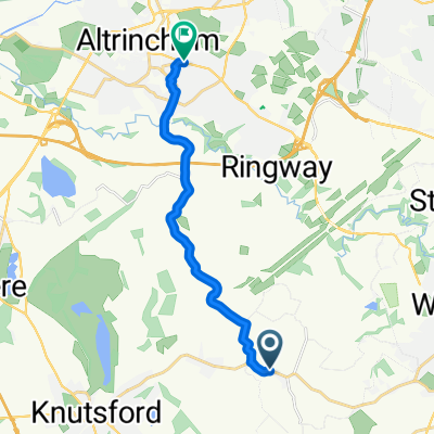
Sandlebridge Farm, Mill Lane, Alderley Edge to 84 Knutsford Road, Alderley Edge
A cycling route starting in Mobberley, England, United Kingdom.
Overview
About this route
- 8 min
- Duration
- 3.3 km
- Distance
- 13 m
- Ascent
- 12 m
- Descent
- 23.9 km/h
- Avg. speed
- 77 m
- Avg. speed

Route quality
Waytypes & surfaces along the route
Waytypes
Quiet road
2.4 km
(73 %)
Busy road
0.9 km
(27 %)
Undefined
0 km
(<1 %)
Surfaces
Paved
0.6 km
(17 %)
Asphalt
0.6 km
(17 %)
Undefined
2.8 km
(83 %)
Continue with Bikemap
Use, edit, or download this cycling route
You would like to ride Sandlebridge Farm, Mill Lane, Alderley Edge to 84 Knutsford Road, Alderley Edge or customize it for your own trip? Here is what you can do with this Bikemap route:
Free features
- Save this route as favorite or in collections
- Copy & plan your own version of this route
- Sync your route with Garmin or Wahoo
Premium features
Free trial for 3 days, or one-time payment. More about Bikemap Premium.
- Navigate this route on iOS & Android
- Export a GPX / KML file of this route
- Create your custom printout (try it for free)
- Download this route for offline navigation
Discover more Premium features.
Get Bikemap PremiumFrom our community
Other popular routes starting in Mobberley
 Paddock Hill, Knutsford to Newton Hall Lane, Knutsford
- Distance
- 2.2 km
- Ascent
- 10 m
- Descent
- 9 m
- Location
- Mobberley, England, United Kingdom
 Sandlebridge Farm, Mill Lane, Alderley Edge to 84 Knutsford Road, Alderley Edge
- Distance
- 3.3 km
- Ascent
- 13 m
- Descent
- 12 m
- Location
- Mobberley, England, United Kingdom
 Hugh Oldham
- Distance
- 24.1 km
- Ascent
- 54 m
- Descent
- 58 m
- Location
- Mobberley, England, United Kingdom
 Training 29.04
- Distance
- 19.4 km
- Ascent
- 78 m
- Descent
- 81 m
- Location
- Mobberley, England, United Kingdom
 Sovereign Stud, Wood Lane, Knutsford to Sovereign Stud, Wood Lane, Knutsford
- Distance
- 19.4 km
- Ascent
- 133 m
- Descent
- 131 m
- Location
- Mobberley, England, United Kingdom
 Oakhurst, Town Lane, Knutsford to Warford Arms Cottages, Faulkner's Lane, Knutsford
- Distance
- 3.2 km
- Ascent
- 37 m
- Descent
- 34 m
- Location
- Mobberley, England, United Kingdom
 Hall Lane, Knutsford to The Limes, 138 Hale Road, Altrincham
- Distance
- 10.1 km
- Ascent
- 0 m
- Descent
- 10 m
- Location
- Mobberley, England, United Kingdom
 Training 13.05
- Distance
- 23.3 km
- Ascent
- 78 m
- Descent
- 78 m
- Location
- Mobberley, England, United Kingdom
Open it in the app