

Ahorn 1
A cycling route starting in Weitramsdorf, Bavaria, Germany.
Overview
About this route
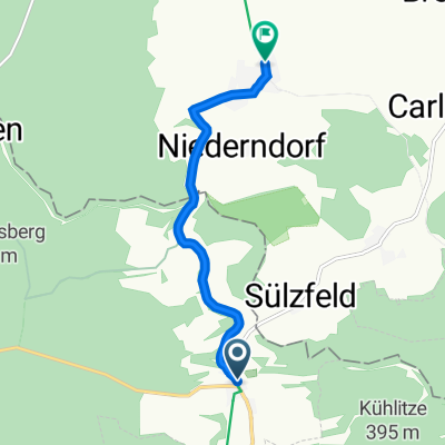
Ahorn towards Bad Staffelstein
- -:--
- Duration
- 56.9 km
- Distance
- 576 m
- Ascent
- 581 m
- Descent
- ---
- Avg. speed
- 387 m
- Max. altitude

Route quality
Waytypes & surfaces along the route
Waytypes
Quiet road
19.9 km
(35 %)
Road
13.1 km
(23 %)
Surfaces
Paved
34.7 km
(61 %)
Unpaved
2.3 km
(4 %)
Asphalt
31.3 km
(55 %)
Paved (undefined)
1.7 km
(3 %)
Continue with Bikemap
Use, edit, or download this cycling route
You would like to ride Ahorn 1 or customize it for your own trip? Here is what you can do with this Bikemap route:
Free features
- Save this route as favorite or in collections
- Copy & plan your own version of this route
- Sync your route with Garmin or Wahoo
Premium features
Free trial for 3 days, or one-time payment. More about Bikemap Premium.
- Navigate this route on iOS & Android
- Export a GPX / KML file of this route
- Create your custom printout (try it for free)
- Download this route for offline navigation
Discover more Premium features.
Get Bikemap PremiumFrom our community
Other popular routes starting in Weitramsdorf
 Ahorn 1
- Distance
- 56.9 km
- Ascent
- 576 m
- Descent
- 581 m
- Location
- Weitramsdorf, Bavaria, Germany
 Ummerstadt - Bad Colberg - Heldburg - Lindenau-Ummerstadt
- Distance
- 17 km
- Ascent
- 193 m
- Descent
- 193 m
- Location
- Weitramsdorf, Bavaria, Germany
 Bad Colberg - Ostheim Rhön (Hotels)
- Distance
- 67.6 km
- Ascent
- 598 m
- Descent
- 592 m
- Location
- Weitramsdorf, Bavaria, Germany
 Runde Tambach - Rodach - Meeder - Scheuerfeld - Tambach
- Distance
- 47.3 km
- Ascent
- 352 m
- Descent
- 350 m
- Location
- Weitramsdorf, Bavaria, Germany
 2018-10-06: Bad Colberg - Seßlach - Bad Staffelstein
- Distance
- 83.6 km
- Ascent
- 647 m
- Descent
- 647 m
- Location
- Weitramsdorf, Bavaria, Germany
 Strecke für den Konditionsaufbau
- Distance
- 17 km
- Ascent
- 77 m
- Descent
- 152 m
- Location
- Weitramsdorf, Bavaria, Germany
 Parkallee 3, Heldburg nach Burgstraße 1, Heldburg
- Distance
- 13.2 km
- Ascent
- 197 m
- Descent
- 127 m
- Location
- Weitramsdorf, Bavaria, Germany
 От Hauptstraße 39A, Heldburg до Rodacher Straße 17, Bad Rodach 11.05.2023
- Distance
- 5.1 km
- Ascent
- 69 m
- Descent
- 62 m
- Location
- Weitramsdorf, Bavaria, Germany
Open it in the app