

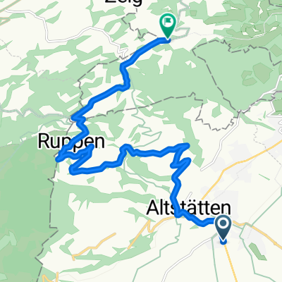
Altstätten nach Schaan, am Rhein entlang nach Altstätten
A cycling route starting in Altstätten, Canton of St. Gallen, Switzerland.
Overview
About this route
- 2 h 50 min
- Duration
- 61.9 km
- Distance
- 239 m
- Ascent
- 699 m
- Descent
- 21.8 km/h
- Avg. speed
- 475 m
- Max. altitude

Route photos


Route quality
Waytypes & surfaces along the route
Waytypes
Quiet road
26.6 km
(43 %)
Track
22.9 km
(37 %)
Surfaces
Paved
57.6 km
(93 %)
Unpaved
2.5 km
(4 %)
Asphalt
57.6 km
(93 %)
Gravel
1.2 km
(2 %)
Continue with Bikemap
Use, edit, or download this cycling route
You would like to ride Altstätten nach Schaan, am Rhein entlang nach Altstätten or customize it for your own trip? Here is what you can do with this Bikemap route:
Free features
- Save this route as favorite or in collections
- Copy & plan your own version of this route
- Sync your route with Garmin or Wahoo
Premium features
Free trial for 3 days, or one-time payment. More about Bikemap Premium.
- Navigate this route on iOS & Android
- Export a GPX / KML file of this route
- Create your custom printout (try it for free)
- Download this route for offline navigation
Discover more Premium features.
Get Bikemap PremiumFrom our community
Other popular routes starting in Altstätten
 Altstätten-ObererGäbris-Gais-Hirschberg-Altstätten
- Distance
- 36.3 km
- Ascent
- 1,197 m
- Descent
- 1,197 m
- Location
- Altstätten, Canton of St. Gallen, Switzerland
 Altstaetten to Sargans
- Distance
- 47.3 km
- Ascent
- 92 m
- Descent
- 81 m
- Location
- Altstätten, Canton of St. Gallen, Switzerland
 Störche-Seeli-Eichberg-Hinterforst-Forst
- Distance
- 20.1 km
- Ascent
- 219 m
- Descent
- 222 m
- Location
- Altstätten, Canton of St. Gallen, Switzerland
 Altstätten nach Schaan, am Rhein entlang nach Altstätten
- Distance
- 61.9 km
- Ascent
- 239 m
- Descent
- 699 m
- Location
- Altstätten, Canton of St. Gallen, Switzerland
 L'Alpe Rheintal
- Distance
- 12.4 km
- Ascent
- 759 m
- Descent
- 90 m
- Location
- Altstätten, Canton of St. Gallen, Switzerland
 Altstätten-Appenzell-Schwägalp-urnäsch- äbris- Altstätten
- Distance
- 76.3 km
- Ascent
- 1,955 m
- Descent
- 1,953 m
- Location
- Altstätten, Canton of St. Gallen, Switzerland
 RHEINDELTA - ROUTE
- Distance
- 59.2 km
- Ascent
- 93 m
- Descent
- 93 m
- Location
- Altstätten, Canton of St. Gallen, Switzerland
 Furkajoch
- Distance
- 117.6 km
- Ascent
- 1,877 m
- Descent
- 1,943 m
- Location
- Altstätten, Canton of St. Gallen, Switzerland
Open it in the app