

Brockentour
A cycling route starting in Wernigerode, Saxony-Anhalt, Germany.
Overview
About this route
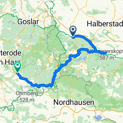
Tour from Wernigerode (Hasserode) over the stone Renne, the upper Hohneweg to Trudestein around Erdbeerkop up to Brockenbett up to Brocken. On the other side, descending the Hirtenstieg to the Ranger Station Scharfenstein. Continuing to the great Sandtal, to Bremen Path and back over Plesenburg via Bielsteinchaussee to the starting point.
- -:--
- Duration
- 39.9 km
- Distance
- 1,133 m
- Ascent
- 977 m
- Descent
- ---
- Avg. speed
- 1,138 m
- Max. altitude

Route quality
Waytypes & surfaces along the route
Waytypes
Track
21.5 km
(54 %)
Quiet road
11.6 km
(29 %)
Surfaces
Paved
7.6 km
(19 %)
Unpaved
30.7 km
(77 %)
Gravel
27.1 km
(68 %)
Asphalt
5.2 km
(13 %)
Continue with Bikemap
Use, edit, or download this cycling route
You would like to ride Brockentour or customize it for your own trip? Here is what you can do with this Bikemap route:
Free features
- Save this route as favorite or in collections
- Copy & plan your own version of this route
- Sync your route with Garmin or Wahoo
Premium features
Free trial for 3 days, or one-time payment. More about Bikemap Premium.
- Navigate this route on iOS & Android
- Export a GPX / KML file of this route
- Create your custom printout (try it for free)
- Download this route for offline navigation
Discover more Premium features.
Get Bikemap PremiumFrom our community
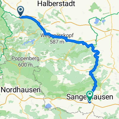
Other popular routes starting in Wernigerode
 Wurmberg
- Distance
- 57.2 km
- Ascent
- 1,056 m
- Descent
- 916 m
- Location
- Wernigerode, Saxony-Anhalt, Germany
 Wernigerode - Halberstadt -Wernigerode
- Distance
- 58.7 km
- Ascent
- 322 m
- Descent
- 322 m
- Location
- Wernigerode, Saxony-Anhalt, Germany
 Zanthiersteintour
- Distance
- 22 km
- Ascent
- 447 m
- Descent
- 444 m
- Location
- Wernigerode, Saxony-Anhalt, Germany
 Burgstraße, Wernigerode to Markt, Südharz
- Distance
- 104.7 km
- Ascent
- 1,521 m
- Descent
- 1,524 m
- Location
- Wernigerode, Saxony-Anhalt, Germany
 300 Harz T1
- Distance
- 90.7 km
- Ascent
- 1,120 m
- Descent
- 1,208 m
- Location
- Wernigerode, Saxony-Anhalt, Germany
 Bahnhofsplatz 12, Wernigerode nach Große Dammstraße 32, Wernigerode
- Distance
- 50 km
- Ascent
- 113 m
- Descent
- 305 m
- Location
- Wernigerode, Saxony-Anhalt, Germany
 Amtsfeldstraße 36A, Wernigerode nach Brocken, Wernigerode
- Distance
- 19.1 km
- Ascent
- 967 m
- Descent
- 119 m
- Location
- Wernigerode, Saxony-Anhalt, Germany
 Route nach Friedrich-Naumann-Straße 43, 38855 Wernigerode
- Distance
- 28.2 km
- Ascent
- 691 m
- Descent
- 694 m
- Location
- Wernigerode, Saxony-Anhalt, Germany
Open it in the app