

Nancy - Bèze (Côte d’Or)
A cycling route starting in Villers-lès-Nancy, Grand Est, France.
Overview
About this route
It's a long route (between 8 and a half and 9 hours in the saddle) but if your legs are in good shape, it can be done in one day.
From Nancy, you first follow the connecting canal, then the cycle path along the Canal de l'Est / Canal des Vosges, which you follow for its entire length, passing through Charmes, Épinal, Bains-les-Bains to Fontenoy-le-Château. The greenway along the canal continues through Selles to Corre (about 135 km from Nancy) where you need to cross the footbridge at the entrance to the village: the paved track continues for a kilometre or two but then ends abruptly with no way to continue.
From Corre, I took the D44 to Jussey, then the D46/D45 to Montigny-lès-Cherlieu and Preigney. Continuing due south on the D1 to Cintrey and Vaite. Throughout this part of the route, you keep climbing and descending long hills: no excessive climbs but it's quite tiring over time. From Vaite, take the D70 to Dampierre-sur-Salon (nice bridge), then secondary roads (D2 then D13) towards Autet, Beaujeu and Corneux (former Premonstratensian abbey, unfortunately closed to the public). Eventually, you reach Gray, cross the Saône on the old bridge and follow the D2 again (Nantilly, Autrey, St-Seine-sur-Vingeanne). You cross the Canal de la Marne to the Saône and continue towards Fontaine-Française (monument in memory of the battle won by Henry IV before entering the village, then castle). Following the D960, you quickly reach the destination, one of the most beautiful villages in France.
Rather than going to Bèze, you can go to Dijon from Gray and take the direct TER back to Nancy.
- -:--
- Duration
- 243.1 km
- Distance
- 1,631 m
- Ascent
- 1,648 m
- Descent
- ---
- Avg. speed
- 384 m
- Max. altitude
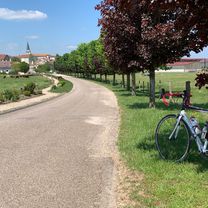
Route photos
\"")
\"")
\"")
\"")
\"")
\"")
\"")
\"")
Route quality
Waytypes & surfaces along the route
Waytypes
Access road
85.1 km
(35 %)
Path
34 km
(14 %)
Surfaces
Paved
158 km
(65 %)
Unpaved
4.9 km
(2 %)
Asphalt
158 km
(65 %)
Gravel
4.9 km
(2 %)
Undefined
80.2 km
(33 %)
Continue with Bikemap
Use, edit, or download this cycling route
You would like to ride Nancy - Bèze (Côte d’Or) or customize it for your own trip? Here is what you can do with this Bikemap route:
Free features
- Save this route as favorite or in collections
- Copy & plan your own version of this route
- Split it into stages to create a multi-day tour
- Sync your route with Garmin or Wahoo
Premium features
Free trial for 3 days, or one-time payment. More about Bikemap Premium.
- Navigate this route on iOS & Android
- Export a GPX / KML file of this route
- Create your custom printout (try it for free)
- Download this route for offline navigation
Discover more Premium features.
Get Bikemap PremiumFrom our community
Other popular routes starting in Villers-lès-Nancy
 Nancy - St. Mihiel
- Distance
- 77 km
- Ascent
- 532 m
- Descent
- 546 m
- Location
- Villers-lès-Nancy, Grand Est, France
 Étang de Lindre
- Distance
- 130.5 km
- Ascent
- 237 m
- Descent
- 237 m
- Location
- Villers-lès-Nancy, Grand Est, France
 Nancy - Bèze (Côte d’Or)
- Distance
- 243.1 km
- Ascent
- 1,631 m
- Descent
- 1,648 m
- Location
- Villers-lès-Nancy, Grand Est, France
 nancy - maron - liverdun
- Distance
- 56.9 km
- Ascent
- 482 m
- Descent
- 485 m
- Location
- Villers-lès-Nancy, Grand Est, France
 Nancy - Vittel
- Distance
- 85.6 km
- Ascent
- 668 m
- Descent
- 566 m
- Location
- Villers-lès-Nancy, Grand Est, France
 Bitche
- Distance
- 132.4 km
- Ascent
- 632 m
- Descent
- 545 m
- Location
- Villers-lès-Nancy, Grand Est, France
 Côte de Toul - Gélaucourt
- Distance
- 101.9 km
- Ascent
- 1,050 m
- Descent
- 1,051 m
- Location
- Villers-lès-Nancy, Grand Est, France
 Thélod
- Distance
- 80 km
- Ascent
- 937 m
- Descent
- 937 m
- Location
- Villers-lès-Nancy, Grand Est, France
Open it in the app