

Traces between east and west (-front)
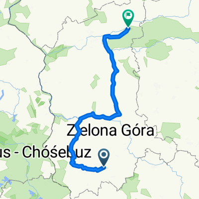
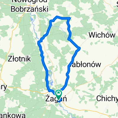
A cycling route starting in Żagań, Lubusz Voivodship, Poland.
Overview
About this route
Shortly before there "Endsieg": The Americans and Soviets met at Strehla and Torgau. Here is a cyclingtourproject at the footsteps of the first U.S. army. From central Germany to the beach of Normandy.
- -:--
- Duration
- 1,841.9 km
- Distance
- 1,572 m
- Ascent
- 1,685 m
- Descent
- ---
- Avg. speed
- ---
- Max. altitude
Route highlights
Points of interest along the route
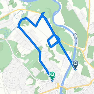
Point of interest after 0 km
Zagan
Point of interest after 211.6 km
Torgau Handschlag Nummer 2 zwischen Amis und Russen - fein nachgestellt für das Bilderhirn.
Point of interest after 242 km
Strehla - Torgau Ami meets Russki
Point of interest after 386.3 km
Naumburg Saale-Unstrut lecker Wein und ab durchs schöne Unstruttal
Point of interest after 495.6 km
Nordhausen 4. Juli 44 in Schutt gelegt, eine Woche später zogen die Amis ein.
Point of interest after 499.2 km
Dora Mittelbau Nachdem Peenemünde eingeflacht wurde zog die V2 Produktion in die Stollen von Dora ein.
Point of interest after 512.1 km
Ab hier je nach Untergrund ein paar Dutzend Kilometer auf dem ehemaligen Grenzstreifen.
Point of interest after 632.3 km
Kassel
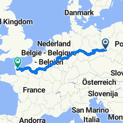
Point of interest after 875 km
Linz
Point of interest after 881.4 km
Remagen Tor ins Reich für die 1. US Armee
Point of interest after 966.7 km
Hürtgenwald Ein Wald der im Lauf der Gefechte völlig entlaubt wurde. An kaum einem Ort hatten die Amis so hohe Verluste. Sinn der Walddurchquerung? Keiner.
Point of interest after 1,023.7 km
Sankt Vith
Point of interest after 1,076.1 km
Bastogne Der Wald vor Bastogne...Ort der heutigen Heldenerzählungen zur 1 US Armee.
Point of interest after 1,130.2 km
Ciergnon
Point of interest after 1,135.2 km
Point of interest after 1,135.6 km
Point of interest after 1,597.7 km
Point of interest after 1,692.2 km
Pont de Normandie Geile Brücke - steht auf meiner Liste der männlichen To Do's.
Point of interest after 1,726.5 km
Point of interest after 1,754.3 km
Caen
Point of interest after 1,831.9 km
Saint-Lô
Continue with Bikemap
Use, edit, or download this cycling route
You would like to ride Traces between east and west (-front) or customize it for your own trip? Here is what you can do with this Bikemap route:
Free features
- Save this route as favorite or in collections
- Copy & plan your own version of this route
- Split it into stages to create a multi-day tour
- Sync your route with Garmin or Wahoo
Premium features
Free trial for 3 days, or one-time payment. More about Bikemap Premium.
- Navigate this route on iOS & Android
- Export a GPX / KML file of this route
- Create your custom printout (try it for free)
- Download this route for offline navigation
Discover more Premium features.
Get Bikemap PremiumFrom our community
Other popular routes starting in Żagań
 TdP 2017 - dzień 2 - Jak nie pana to sraczka
- Distance
- 244.4 km
- Ascent
- 295 m
- Descent
- 417 m
- Location
- Żagań, Lubusz Voivodship, Poland
 Traces between east and west (-front)
- Distance
- 1,841.9 km
- Ascent
- 1,572 m
- Descent
- 1,685 m
- Location
- Żagań, Lubusz Voivodship, Poland
 Skarbowa 19/21, Żagań do Lubuska 1A, Żagań
- Distance
- 7.5 km
- Ascent
- 16 m
- Descent
- 17 m
- Location
- Żagań, Lubusz Voivodship, Poland
 Z Żagania 1
- Distance
- 58.9 km
- Ascent
- 130 m
- Descent
- 128 m
- Location
- Żagań, Lubusz Voivodship, Poland
 Z Żagania 2
- Distance
- 64 km
- Ascent
- 196 m
- Descent
- 197 m
- Location
- Żagań, Lubusz Voivodship, Poland
 Z Żagania 3
- Distance
- 68.9 km
- Ascent
- 117 m
- Descent
- 119 m
- Location
- Żagań, Lubusz Voivodship, Poland
 Z Żagania 4
- Distance
- 47.8 km
- Ascent
- 124 m
- Descent
- 127 m
- Location
- Żagań, Lubusz Voivodship, Poland
 Żagań Doliną Bobru
- Distance
- 29.6 km
- Ascent
- 108 m
- Descent
- 109 m
- Location
- Żagań, Lubusz Voivodship, Poland
Open it in the app