
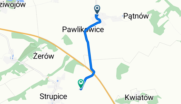
strupice
A cycling route starting in Chojnów, Lower Silesian Voivodeship, Poland.
Overview
About this route
- 13 min
- Duration
- 2.4 km
- Distance
- 33 m
- Ascent
- 0 m
- Descent
- 11 km/h
- Avg. speed
- 181 m
- Max. altitude

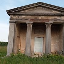
Route photos

Route quality
Waytypes & surfaces along the route
Waytypes
Track
1.7 km
(68 %)
Quiet road
0.8 km
(32 %)
Surfaces
Paved
0 km
(2 %)
Unpaved
1.6 km
(66 %)
Unpaved (undefined)
1.6 km
(66 %)
Paved (undefined)
0 km
(2 %)
Undefined
0.8 km
(32 %)
Continue with Bikemap
Use, edit, or download this cycling route
You would like to ride strupice or customize it for your own trip? Here is what you can do with this Bikemap route:
Free features
- Save this route as favorite or in collections
- Copy & plan your own version of this route
- Sync your route with Garmin or Wahoo
Premium features
Free trial for 3 days, or one-time payment. More about Bikemap Premium.
- Navigate this route on iOS & Android
- Export a GPX / KML file of this route
- Create your custom printout (try it for free)
- Download this route for offline navigation
Discover more Premium features.
Get Bikemap PremiumFrom our community
Other popular routes starting in Chojnów
 From Gmina Chojnów to Zagrodno
- Distance
- 27 km
- Ascent
- 293 m
- Descent
- 53 m
- Location
- Chojnów, Lower Silesian Voivodeship, Poland
 na sobote
- Distance
- 83.9 km
- Ascent
- 150 m
- Descent
- 150 m
- Location
- Chojnów, Lower Silesian Voivodeship, Poland
 25C do 25C
- Distance
- 62.2 km
- Ascent
- 349 m
- Descent
- 394 m
- Location
- Chojnów, Lower Silesian Voivodeship, Poland
 Wojska Polskiego 16, Chojnów do Wojska Polskiego 14, Chojnów
- Distance
- 15.8 km
- Ascent
- 240 m
- Descent
- 322 m
- Location
- Chojnów, Lower Silesian Voivodeship, Poland
 strupice
- Distance
- 2.4 km
- Ascent
- 33 m
- Descent
- 0 m
- Location
- Chojnów, Lower Silesian Voivodeship, Poland
 Chojnów Malczyce
- Distance
- 75.6 km
- Ascent
- 123 m
- Descent
- 158 m
- Location
- Chojnów, Lower Silesian Voivodeship, Poland
 Wojska Polskiego 16, Chojnów do Wojska Polskiego 14, Chojnów
- Distance
- 9.1 km
- Ascent
- 545 m
- Descent
- 573 m
- Location
- Chojnów, Lower Silesian Voivodeship, Poland
 Rokitki - chocianów - Legnica
- Distance
- 46.4 km
- Ascent
- 104 m
- Descent
- 120 m
- Location
- Chojnów, Lower Silesian Voivodeship, Poland
Open it in the app