

Albussac (Les Quatre Routes) - Circle to Brive-la-Gaillarde (Malemort)
A cycling route starting in Beynat, Nouvelle-Aquitaine, France.
Overview
About this route
This turned into a heck of a ride. A few kilometers after leaving Brive while on D141E3, thunder, lighting, and really heavy rains started up. For a half hour or so, we took shelter where a building had a covered entryway in St-Hilaire-Peyroux. After that, we took a wrong turn when it was raining and we ended up having to ride some on D1089, which was less than pleasant...especially in the rain. This road also had some tunnels; fortunately, we had some tail-lights that we put on the bikes since with the heavy overcast and rain it was relatively dark. Eventually we got to Cornil, where we could pick up D1 to head due east to Ste-Fortunade and D940, which then allowed us to head south back to our hotel. Our original destination was Tulle, where we intended to do some grocery shopping and pick up some McDonalds items for our dinner. With the thunder, lightning, and rain, we bypassed Tulle...maybe tomorrow.
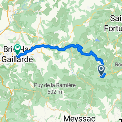
With the exception of being inside Malemort and on D1089, all roads were excellent. D921 from Les Quatre Routes to Malemort was surprisingly good with relatively little traffic.
- 4 h 31 min
- Duration
- 75.3 km
- Distance
- 1,422 m
- Ascent
- 1,422 m
- Descent
- 16.7 km/h
- Avg. speed
- 570 m
- Max. altitude

Route photos
 - Circle to Brive-la-Gaillarde (Malemort)\"")
 - Circle to Brive-la-Gaillarde (Malemort)\"")
 - Circle to Brive-la-Gaillarde (Malemort)\"")
 - Circle to Brive-la-Gaillarde (Malemort)\"")
 - Circle to Brive-la-Gaillarde (Malemort)\"")
 - Circle to Brive-la-Gaillarde (Malemort)\"")
 - Circle to Brive-la-Gaillarde (Malemort)\"")
Route quality
Waytypes & surfaces along the route
Waytypes
Road
15.8 km
(21 %)
Quiet road
4.5 km
(6 %)
Surfaces
Paved
30.9 km
(41 %)
Asphalt
30.9 km
(41 %)
Undefined
44.4 km
(59 %)
Continue with Bikemap
Use, edit, or download this cycling route
You would like to ride Albussac (Les Quatre Routes) - Circle to Brive-la-Gaillarde (Malemort) or customize it for your own trip? Here is what you can do with this Bikemap route:
Free features
- Save this route as favorite or in collections
- Copy & plan your own version of this route
- Sync your route with Garmin or Wahoo
Premium features
Free trial for 3 days, or one-time payment. More about Bikemap Premium.
- Navigate this route on iOS & Android
- Export a GPX / KML file of this route
- Create your custom printout (try it for free)
- Download this route for offline navigation
Discover more Premium features.
Get Bikemap PremiumFrom our community
Other popular routes starting in Beynat
 Albussac (Les Quatre Routes) - Circle through Neuville
- Distance
- 37.8 km
- Ascent
- 686 m
- Descent
- 686 m
- Location
- Beynat, Nouvelle-Aquitaine, France
 Albussac (Les Quatre Routes) - Circle to Brive-la-Gaillarde (Malemort)
- Distance
- 75.3 km
- Ascent
- 1,422 m
- Descent
- 1,422 m
- Location
- Beynat, Nouvelle-Aquitaine, France
 Albussac (Les Quatre Routes) to Égletons
- Distance
- 53.5 km
- Ascent
- 978 m
- Descent
- 889 m
- Location
- Beynat, Nouvelle-Aquitaine, France
 From Beynat to Brive-la-Gaillarde
- Distance
- 28.7 km
- Ascent
- 485 m
- Descent
- 760 m
- Location
- Beynat, Nouvelle-Aquitaine, France
 Albussac (Les Quatre Routes) - Circle through Tulle
- Distance
- 59.4 km
- Ascent
- 1,179 m
- Descent
- 1,180 m
- Location
- Beynat, Nouvelle-Aquitaine, France
 Palazinges - Barrage aigle
- Distance
- 66.7 km
- Ascent
- 508 m
- Descent
- 764 m
- Location
- Beynat, Nouvelle-Aquitaine, France
 le planchat
- Distance
- 3.8 km
- Ascent
- 212 m
- Descent
- 93 m
- Location
- Beynat, Nouvelle-Aquitaine, France
 espagnagol
- Distance
- 7.1 km
- Ascent
- 135 m
- Descent
- 135 m
- Location
- Beynat, Nouvelle-Aquitaine, France
Open it in the app