

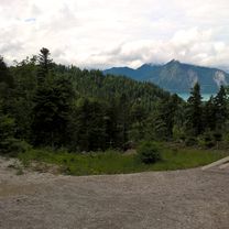
Herbstliche Jachenau
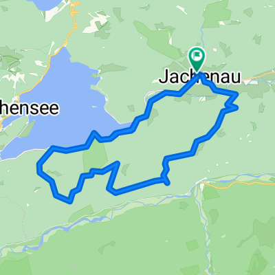
A cycling route starting in Jachenau, Bavaria, Germany.
Overview
About this route
Gefahren am 1.10.2011
33km plus Foto-Schlenker am Walchensee;
Nette Trailabfahrt
Einkehr erst am Walchensee möglich, vorher keine bewirtschaftete Hütte
Aber Brotzzeitrast am Hochkopf schön
- -:--
- Duration
- 36.5 km
- Distance
- 878 m
- Ascent
- 879 m
- Descent
- ---
- Avg. speed
- ---
- Max. altitude
Continue with Bikemap
Use, edit, or download this cycling route
You would like to ride Herbstliche Jachenau or customize it for your own trip? Here is what you can do with this Bikemap route:
Free features
- Save this route as favorite or in collections
- Copy & plan your own version of this route
- Sync your route with Garmin or Wahoo
Premium features
Free trial for 3 days, or one-time payment. More about Bikemap Premium.
- Navigate this route on iOS & Android
- Export a GPX / KML file of this route
- Create your custom printout (try it for free)
- Download this route for offline navigation
Discover more Premium features.
Get Bikemap PremiumFrom our community
Other popular routes starting in Jachenau
 Jachenau Silvensteinrunde
- Distance
- 58.8 km
- Ascent
- 621 m
- Descent
- 622 m
- Location
- Jachenau, Bavaria, Germany
 Jachenau 4
- Distance
- 67 km
- Ascent
- 375 m
- Descent
- 375 m
- Location
- Jachenau, Bavaria, Germany
 Luitpolderalm
- Distance
- 20.8 km
- Ascent
- 505 m
- Descent
- 507 m
- Location
- Jachenau, Bavaria, Germany
 Herbstliche Spazierfahrt
- Distance
- 45.2 km
- Ascent
- 817 m
- Descent
- 817 m
- Location
- Jachenau, Bavaria, Germany
 Labelsberg-Wanderung
- Distance
- 5.8 km
- Ascent
- 697 m
- Descent
- 57 m
- Location
- Jachenau, Bavaria, Germany
 Oberlandtour Bayern
- Distance
- 52 km
- Ascent
- 108 m
- Descent
- 111 m
- Location
- Jachenau, Bavaria, Germany
 Große Jachenau-Runde
- Distance
- 33 km
- Ascent
- 428 m
- Descent
- 375 m
- Location
- Jachenau, Bavaria, Germany
 Herbstliche Jachenau
- Distance
- 36.5 km
- Ascent
- 878 m
- Descent
- 879 m
- Location
- Jachenau, Bavaria, Germany
Open it in the app