

Donderdag 2
A cycling route starting in Pont Rouge, Quebec, Canada.
Overview
About this route
- -:--
- Duration
- 279.8 km
- Distance
- 1,131 m
- Ascent
- 1,123 m
- Descent
- ---
- Avg. speed
- 157 m
- Max. altitude

Route quality
Waytypes & surfaces along the route
Waytypes
Cycleway
100.7 km
(36 %)
Quiet road
64.3 km
(23 %)
Surfaces
Paved
246.2 km
(88 %)
Unpaved
5.6 km
(2 %)
Asphalt
187.4 km
(67 %)
Paved (undefined)
58.8 km
(21 %)
Continue with Bikemap
Use, edit, or download this cycling route
You would like to ride Donderdag 2 or customize it for your own trip? Here is what you can do with this Bikemap route:
Free features
- Save this route as favorite or in collections
- Copy & plan your own version of this route
- Split it into stages to create a multi-day tour
- Sync your route with Garmin or Wahoo
Premium features
Free trial for 3 days, or one-time payment. More about Bikemap Premium.
- Navigate this route on iOS & Android
- Export a GPX / KML file of this route
- Create your custom printout (try it for free)
- Download this route for offline navigation
Discover more Premium features.
Get Bikemap PremiumFrom our community
Other popular routes starting in Pont Rouge
 Pointe-Taillon / Alma (Arrivée) (JOUR 6)
- Distance
- 40.5 km
- Ascent
- 245 m
- Descent
- 229 m
- Location
- Pont Rouge, Quebec, Canada
 Donderdag 2
- Distance
- 279.8 km
- Ascent
- 1,131 m
- Descent
- 1,123 m
- Location
- Pont Rouge, Quebec, Canada
 Pont Rouge - Jonquière
- Distance
- 77.8 km
- Ascent
- 115 m
- Descent
- 59 m
- Location
- Pont Rouge, Quebec, Canada
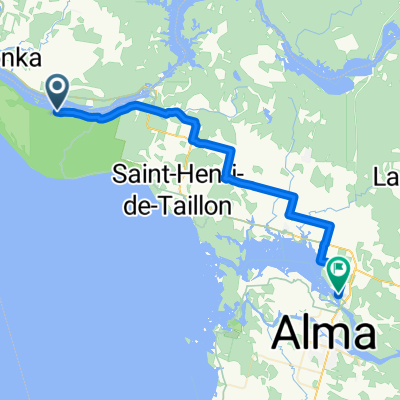
 Rue Édouard Niquet 304, Péribonka to Rue des Pins Ouest 890, Alma
- Distance
- 54.3 km
- Ascent
- 271 m
- Descent
- 271 m
- Location
- Pont Rouge, Quebec, Canada
 Rue du Vieux-Moulin, Ste-Jeanne-d'Arc à Ste-Jeanne-d'Arc
- Distance
- 3.6 km
- Ascent
- 34 m
- Descent
- 10 m
- Location
- Pont Rouge, Quebec, Canada
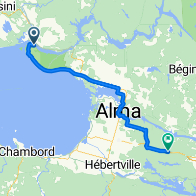
 Tour du Lac St-Jean - Jour 2
- Distance
- 120.1 km
- Ascent
- 236 m
- Descent
- 235 m
- Location
- Pont Rouge, Quebec, Canada
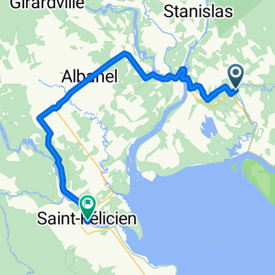 Pont Rouge - Saint-Félicien
- Distance
- 76.5 km
- Ascent
- 215 m
- Descent
- 230 m
- Location
- Pont Rouge, Quebec, Canada
 Péribonka vers Normandin
- Distance
- 62.9 km
- Ascent
- 248 m
- Descent
- 207 m
- Location
- Pont Rouge, Quebec, Canada
Open it in the app