

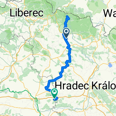
Roztoky-Tample-Bělá-Libštát-Košťálov-Kundratice-Kruh-Roztoky
A cycling route starting in Studenec, Liberecký kraj, Czechia.
Overview
About this route
Lehčí trasa s několika většími stoupáními
- -:--
- Duration
- 23.9 km
- Distance
- 253 m
- Ascent
- 255 m
- Descent
- ---
- Avg. speed
- ---
- Max. altitude
Continue with Bikemap
Use, edit, or download this cycling route
You would like to ride Roztoky-Tample-Bělá-Libštát-Košťálov-Kundratice-Kruh-Roztoky or customize it for your own trip? Here is what you can do with this Bikemap route:
Free features
- Save this route as favorite or in collections
- Copy & plan your own version of this route
- Sync your route with Garmin or Wahoo
Premium features
Free trial for 3 days, or one-time payment. More about Bikemap Premium.
- Navigate this route on iOS & Android
- Export a GPX / KML file of this route
- Create your custom printout (try it for free)
- Download this route for offline navigation
Discover more Premium features.
Get Bikemap PremiumFrom our community
Other popular routes starting in Studenec
 krkonosske kolecko
- Distance
- 78.8 km
- Ascent
- 609 m
- Descent
- 713 m
- Location
- Studenec, Liberecký kraj, Czechia
 Silnice 32546, Vidochov to náměstí Karla Václava Raise 13, Lázně Bělohrad
- Distance
- 13.8 km
- Ascent
- 35 m
- Descent
- 257 m
- Location
- Studenec, Liberecký kraj, Czechia
 Vyjizdka na Zaly
- Distance
- 54.1 km
- Ascent
- 896 m
- Descent
- 990 m
- Location
- Studenec, Liberecký kraj, Czechia
 Okruh1
- Distance
- 21.6 km
- Ascent
- 211 m
- Descent
- 210 m
- Location
- Studenec, Liberecký kraj, Czechia
 2014_04_19
- Distance
- 128.5 km
- Ascent
- 1,220 m
- Descent
- 1,220 m
- Location
- Studenec, Liberecký kraj, Czechia
 190615 Zlaté návrší
- Distance
- 136.3 km
- Ascent
- 1,397 m
- Descent
- 1,656 m
- Location
- Studenec, Liberecký kraj, Czechia
 Roztoky-Martinice-Zálesní Lhota-Horní Kalná-Dolní Kalná-Bukovina-Studenec-Žďár-Roztoky
- Distance
- 32.7 km
- Ascent
- 289 m
- Descent
- 289 m
- Location
- Studenec, Liberecký kraj, Czechia
 Bukovina-Miletín-Lázně Běloves
- Distance
- 62.5 km
- Ascent
- 749 m
- Descent
- 749 m
- Location
- Studenec, Liberecký kraj, Czechia
Open it in the app