

Route from Petőfi Sándor utca 2, Bucsu
A cycling route starting in Gencsapáti, Vas County, Hungary.
Overview
About this route
- 10 h 35 min
- Duration
- 209.6 km
- Distance
- 1,561 m
- Ascent
- 1,681 m
- Descent
- 19.8 km/h
- Avg. speed
- 387 m
- Max. altitude

Route quality
Waytypes & surfaces along the route
Waytypes
Road
33.5 km
(16 %)
Quiet road
10.5 km
(5 %)
Surfaces
Paved
169.8 km
(81 %)
Asphalt
165.6 km
(79 %)
Paved (undefined)
4.2 km
(2 %)
Undefined
39.8 km
(19 %)
Continue with Bikemap
Use, edit, or download this cycling route
You would like to ride Route from Petőfi Sándor utca 2, Bucsu or customize it for your own trip? Here is what you can do with this Bikemap route:
Free features
- Save this route as favorite or in collections
- Copy & plan your own version of this route
- Split it into stages to create a multi-day tour
- Sync your route with Garmin or Wahoo
Premium features
Free trial for 3 days, or one-time payment. More about Bikemap Premium.
- Navigate this route on iOS & Android
- Export a GPX / KML file of this route
- Create your custom printout (try it for free)
- Download this route for offline navigation
Discover more Premium features.
Get Bikemap PremiumFrom our community
Other popular routes starting in Gencsapáti
 Route from Petőfi Sándor utca 2, Bucsu
- Distance
- 209.6 km
- Ascent
- 1,561 m
- Descent
- 1,681 m
- Location
- Gencsapáti, Vas County, Hungary
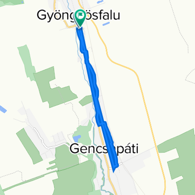 8721 124, Gyöngyösfalu to Petőfi Sándor utca 122, Gyöngyösfalu
- Distance
- 6.7 km
- Ascent
- 33 m
- Descent
- 31 m
- Location
- Gencsapáti, Vas County, Hungary
 ZsoTa No. 2.
- Distance
- 69.3 km
- Ascent
- 574 m
- Descent
- 573 m
- Location
- Gencsapáti, Vas County, Hungary
 Narda - Oberwart ~ 26.08 km
- Distance
- 26.1 km
- Ascent
- 191 m
- Descent
- 154 m
- Location
- Gencsapáti, Vas County, Hungary
 8721 124, Gyöngyösfalu - Petőfi Sándor utca 124, Gyöngyösfalu
- Distance
- 4.8 km
- Ascent
- 14 m
- Descent
- 16 m
- Location
- Gencsapáti, Vas County, Hungary
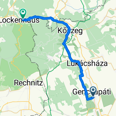 Gravel Gencsapáti - Lockenhaus
- Distance
- 27.4 km
- Ascent
- 335 m
- Descent
- 242 m
- Location
- Gencsapáti, Vas County, Hungary
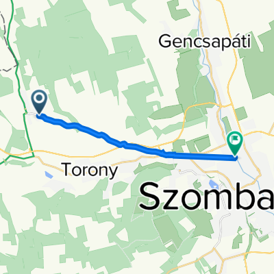 87133, Bucsu - Paragvári utca 106, Szombathely
- Distance
- 8.9 km
- Ascent
- 7 m
- Descent
- 62 m
- Location
- Gencsapáti, Vas County, Hungary
 Szombathely - Kőszeg - Szent Vid - Szombathely
- Distance
- 79.7 km
- Ascent
- 734 m
- Descent
- 733 m
- Location
- Gencsapáti, Vas County, Hungary
Open it in the app