
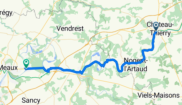
20230711-Chateau Thierry-Trilport
A cycling route starting in Château-Thierry, Hauts-de-France, France.
Overview
About this route
- -:--
- Duration
- 48 km
- Distance
- 221 m
- Ascent
- 236 m
- Descent
- ---
- Avg. speed
- 120 m
- Max. altitude

Route quality
Waytypes & surfaces along the route
Waytypes
Track
23.1 km
(48 %)
Road
7.7 km
(16 %)
Surfaces
Paved
10.1 km
(21 %)
Unpaved
21.6 km
(45 %)
Unpaved (undefined)
17.8 km
(37 %)
Asphalt
9.1 km
(19 %)
Continue with Bikemap
Use, edit, or download this cycling route
You would like to ride 20230711-Chateau Thierry-Trilport or customize it for your own trip? Here is what you can do with this Bikemap route:
Free features
- Save this route as favorite or in collections
- Copy & plan your own version of this route
- Sync your route with Garmin or Wahoo
Premium features
Free trial for 3 days, or one-time payment. More about Bikemap Premium.
- Navigate this route on iOS & Android
- Export a GPX / KML file of this route
- Create your custom printout (try it for free)
- Download this route for offline navigation
Discover more Premium features.
Get Bikemap PremiumFrom our community
Other popular routes starting in Château-Thierry
 Friedensradfahrt 2009 Paris - Moskau 3. Etappe Chateau-Thierry - Tilloy am 7. Juli 2009
- Distance
- 114.2 km
- Ascent
- 420 m
- Descent
- 315 m
- Location
- Château-Thierry, Hauts-de-France, France
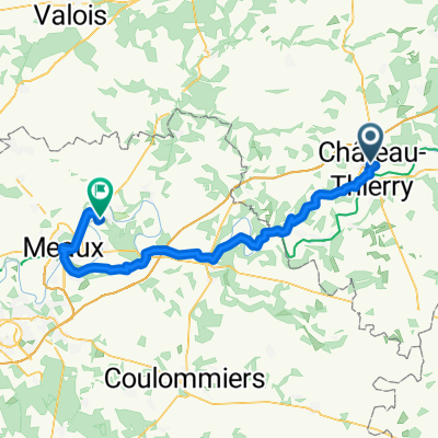 20250902_Château-Thierry - Germigny-l'Évêque
- Distance
- 64.1 km
- Ascent
- 517 m
- Descent
- 619 m
- Location
- Château-Thierry, Hauts-de-France, France
 Dag7TRGMJ2018
- Distance
- 95.6 km
- Ascent
- 246 m
- Descent
- 255 m
- Location
- Château-Thierry, Hauts-de-France, France
 20230711-Chateau Thierry-Trilport
- Distance
- 48 km
- Ascent
- 221 m
- Descent
- 236 m
- Location
- Château-Thierry, Hauts-de-France, France
 11 Villepinte 2
- Distance
- 86.6 km
- Ascent
- 408 m
- Descent
- 407 m
- Location
- Château-Thierry, Hauts-de-France, France
 Moderate route in Courtemont-Varennes
- Distance
- 18.6 km
- Ascent
- 160 m
- Descent
- 279 m
- Location
- Château-Thierry, Hauts-de-France, France
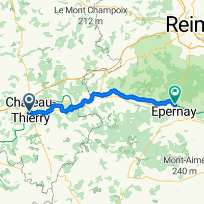 Château-Thierry - Dizy
- Distance
- 51.6 km
- Ascent
- 269 m
- Descent
- 262 m
- Location
- Château-Thierry, Hauts-de-France, France
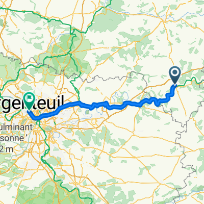 EPERNAY PARIS - J2
- Distance
- 110 km
- Ascent
- 576 m
- Descent
- 618 m
- Location
- Château-Thierry, Hauts-de-France, France
Open it in the app