
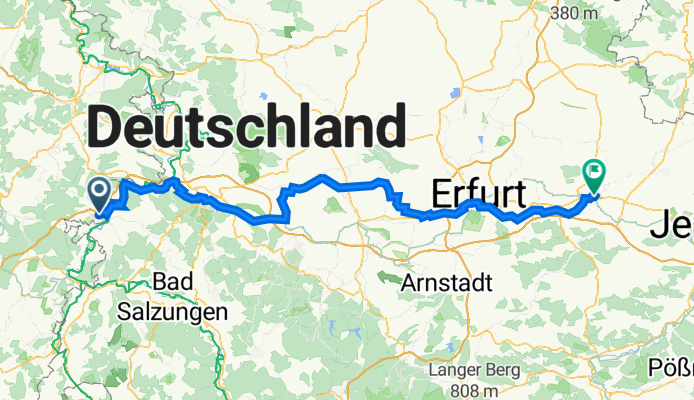
Eisenacher Straße 39, Wildeck nach Kegelplatz 2, Weimar
A cycling route starting in Gerstungen, Free State of Thuringia, Germany.
Overview
About this route
- 7 h 58 min
- Duration
- 127.2 km
- Distance
- 821 m
- Ascent
- 827 m
- Descent
- 16 km/h
- Avg. speed
- 369 m
- Max. altitude
Route quality
Waytypes & surfaces along the route
Waytypes
Quiet road
39.9 km
(31 %)
Road
29.2 km
(23 %)
Surfaces
Paved
102 km
(80 %)
Unpaved
4.5 km
(4 %)
Asphalt
92.6 km
(73 %)
Gravel
4.5 km
(4 %)
Continue with Bikemap
Use, edit, or download this cycling route
You would like to ride Eisenacher Straße 39, Wildeck nach Kegelplatz 2, Weimar or customize it for your own trip? Here is what you can do with this Bikemap route:
Free features
- Save this route as favorite or in collections
- Copy & plan your own version of this route
- Split it into stages to create a multi-day tour
- Sync your route with Garmin or Wahoo
Premium features
Free trial for 3 days, or one-time payment. More about Bikemap Premium.
- Navigate this route on iOS & Android
- Export a GPX / KML file of this route
- Create your custom printout (try it for free)
- Download this route for offline navigation
Discover more Premium features.
Get Bikemap PremiumFrom our community
Other popular routes starting in Gerstungen
 Untersuhl- Berka- Abteroda- Springen- Kieselbach- Krayenburg- Tiefenort- Dönges- Fernbreitenbach- Gerstungen- Untersuhl
- Distance
- 51.1 km
- Ascent
- 755 m
- Descent
- 755 m
- Location
- Gerstungen, Free State of Thuringia, Germany
 U-Wildeck-Blumenstein-Bauhaus-HoheSüss-Diebesnest-L3248-Richtung KasparsBuche-Weg oberhalb Richelsdorf-Untersuhl
- Distance
- 30.8 km
- Ascent
- 1,117 m
- Descent
- 1,121 m
- Location
- Gerstungen, Free State of Thuringia, Germany
 Gerstungen
- Distance
- 27.4 km
- Ascent
- 142 m
- Descent
- 140 m
- Location
- Gerstungen, Free State of Thuringia, Germany
 Untersuhl-Säulingswald- Untersuhl
- Distance
- 69.3 km
- Ascent
- 1,249 m
- Descent
- 1,250 m
- Location
- Gerstungen, Free State of Thuringia, Germany
 Untersuhl-Richtung Autobahn-BrackEiche-Kohlbachquelle-Kohlbachhaus-Richtung Kirche-Neustaedt-Sallmannshausen-Werraradwanderweg-Gerstungen-Untersuhl
- Distance
- 27.1 km
- Ascent
- 0 m
- Descent
- 216 m
- Location
- Gerstungen, Free State of Thuringia, Germany
 Untersuhl-Obersuhl-Dankmarshausen-Heringen-Richtung Bengendorf-Kirchenkopf-Gräfeweg-Bodesruh-Hönebach-Bahnrettungsweg-Bosserode-Obersuhl-Untersuhl
- Distance
- 37.6 km
- Ascent
- 708 m
- Descent
- 714 m
- Location
- Gerstungen, Free State of Thuringia, Germany
 Untersuhl- Berka- Napoleonweg- Dippach- Dankmarshausen- Waldhaus- Bodesruh- Hönebach- Bosserode- Rähden- Obersuhl- Untersuhl
- Distance
- 28.8 km
- Ascent
- 366 m
- Descent
- 368 m
- Location
- Gerstungen, Free State of Thuringia, Germany
 Untersuhl- Dankmarshausen- Widdershausen- Kaliberg- Bengendorf- Wolfram Wolf Hütte- Richtung Hammundeseiche- A4 Überquerung- Hönebach- Bosserode- Obersuhl- Unte
- Distance
- 37.9 km
- Ascent
- 482 m
- Descent
- 482 m
- Location
- Gerstungen, Free State of Thuringia, Germany
Open it in the app