

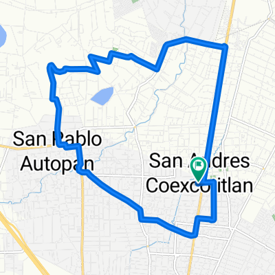
De Aguascalientes 37, Jicaltepec Autopan a Carretera Toluca-Temoaya 7700, Fraccionamiento La Florida
A cycling route starting in Jicaltepec Cuexcontitlán, State of Mexico, Mexico.
Overview
About this route
- 1 h 48 min
- Duration
- 41.4 km
- Distance
- 122 m
- Ascent
- 118 m
- Descent
- 23 km/h
- Avg. speed
- 2,623 m
- Max. altitude

Route quality
Waytypes & surfaces along the route
Waytypes
Busy road
19.2 km
(46 %)
Road
10.1 km
(24 %)
Surfaces
Paved
24.8 km
(60 %)
Unpaved
0 km
(<1 %)
Asphalt
23 km
(56 %)
Concrete
1.2 km
(3 %)
Continue with Bikemap
Use, edit, or download this cycling route
You would like to ride De Aguascalientes 37, Jicaltepec Autopan a Carretera Toluca-Temoaya 7700, Fraccionamiento La Florida or customize it for your own trip? Here is what you can do with this Bikemap route:
Free features
- Save this route as favorite or in collections
- Copy & plan your own version of this route
- Sync your route with Garmin or Wahoo
Premium features
Free trial for 3 days, or one-time payment. More about Bikemap Premium.
- Navigate this route on iOS & Android
- Export a GPX / KML file of this route
- Create your custom printout (try it for free)
- Download this route for offline navigation
Discover more Premium features.
Get Bikemap PremiumFrom our community
Other popular routes starting in Jicaltepec Cuexcontitlán
 De Aguascalientes 37, Jicaltepec Autopan a Avenida Estado de México 12, Toluca de Lerdo
- Distance
- 41.1 km
- Ascent
- 123 m
- Descent
- 121 m
- Location
- Jicaltepec Cuexcontitlán, State of Mexico, Mexico
 Ruta desde Paseo Amapolas, Fraccionamiento La Florida
- Distance
- 4.3 km
- Ascent
- 4 m
- Descent
- 0 m
- Location
- Jicaltepec Cuexcontitlán, State of Mexico, Mexico
 De Vicente Guerrero 884, San Andrés Cuexcontitlán a México 53 8, Toluca de Lerdo
- Distance
- 88.5 km
- Ascent
- 2,252 m
- Descent
- 2,249 m
- Location
- Jicaltepec Cuexcontitlán, State of Mexico, Mexico
 De Valle de Bravo 310, San Andrés Cuexcontitlán a Avenida Tecnológico 108, Metepec
- Distance
- 14 km
- Ascent
- 57 m
- Descent
- 58 m
- Location
- Jicaltepec Cuexcontitlán, State of Mexico, Mexico
 De Aguascalientes 37, Jicaltepec Autopan a Carretera Toluca-Temoaya 7700, Fraccionamiento La Florida
- Distance
- 41.4 km
- Ascent
- 122 m
- Descent
- 118 m
- Location
- Jicaltepec Cuexcontitlán, State of Mexico, Mexico
 Calle Ignacio Matamoros, San Andrés Cuexcontitlán a Calle Ignacio Matamoros, San Andrés Cuexcontitlán
- Distance
- 17.4 km
- Ascent
- 174 m
- Descent
- 164 m
- Location
- Jicaltepec Cuexcontitlán, State of Mexico, Mexico
Open it in the app