

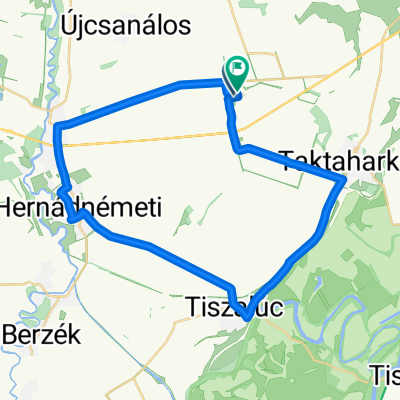
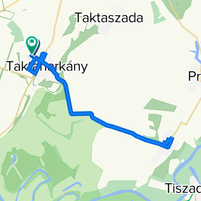
Kazinczy utca 42., Taktaharkány to Kodály Zoltán utca 39., Taktaharkány
A cycling route starting in Taktaharkány, Borsod-Abauj Zemplen county, Hungary.
Overview
About this route
- 1 h 18 min
- Duration
- 17.4 km
- Distance
- 46 m
- Ascent
- 48 m
- Descent
- 13.4 km/h
- Avg. speed
- 112 m
- Avg. speed

Route quality
Waytypes & surfaces along the route
Waytypes
Busy road
11.5 km
(66 %)
Quiet road
3.2 km
(19 %)
Surfaces
Paved
1.2 km
(7 %)
Unpaved
0.9 km
(5 %)
Asphalt
1.2 km
(7 %)
Unpaved (undefined)
0.9 km
(5 %)
Undefined
15.3 km
(88 %)
Continue with Bikemap
Use, edit, or download this cycling route
You would like to ride Kazinczy utca 42., Taktaharkány to Kodály Zoltán utca 39., Taktaharkány or customize it for your own trip? Here is what you can do with this Bikemap route:
Free features
- Save this route as favorite or in collections
- Copy & plan your own version of this route
- Sync your route with Garmin or Wahoo
Premium features
Free trial for 3 days, or one-time payment. More about Bikemap Premium.
- Navigate this route on iOS & Android
- Export a GPX / KML file of this route
- Create your custom printout (try it for free)
- Download this route for offline navigation
Discover more Premium features.
Get Bikemap PremiumFrom our community
Other popular routes starting in Taktaharkány
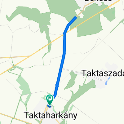
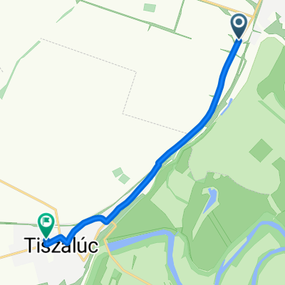 3611, Taktaharkány to Dózsa György utca 6, Tiszalúc
- Distance
- 7.2 km
- Ascent
- 25 m
- Descent
- 31 m
- Location
- Taktaharkány, Borsod-Abauj Zemplen county, Hungary
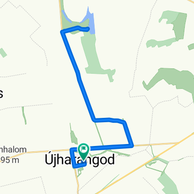 Rózsa utca 4., Újharangod to Rózsa utca 4., Újharangod
- Distance
- 21.5 km
- Ascent
- 198 m
- Descent
- 187 m
- Location
- Taktaharkány, Borsod-Abauj Zemplen county, Hungary
 Steady ride in
- Distance
- 35.7 km
- Ascent
- 176 m
- Descent
- 180 m
- Location
- Taktaharkány, Borsod-Abauj Zemplen county, Hungary
 Kazinczy utca 42., Taktaharkány to Kodály Zoltán utca 39., Taktaharkány
- Distance
- 17.4 km
- Ascent
- 46 m
- Descent
- 48 m
- Location
- Taktaharkány, Borsod-Abauj Zemplen county, Hungary
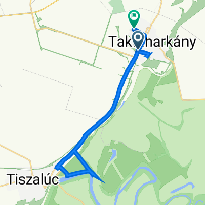
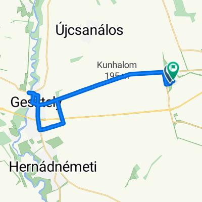
 Megyaszói utca 4–10., Taktaharkány to Kodály Zoltán utca 39., Taktaharkány
- Distance
- 23.6 km
- Ascent
- 12 m
- Descent
- 13 m
- Location
- Taktaharkány, Borsod-Abauj Zemplen county, Hungary
 Easy ride in Újharangod
- Distance
- 21.5 km
- Ascent
- 158 m
- Descent
- 144 m
- Location
- Taktaharkány, Borsod-Abauj Zemplen county, Hungary
 Restful route in Taktaharkány
- Distance
- 11.7 km
- Ascent
- 44 m
- Descent
- 30 m
- Location
- Taktaharkány, Borsod-Abauj Zemplen county, Hungary
Open it in the app