

DD-Oberland
A cycling route starting in Dresden, Saxony, Germany.
Overview
About this route
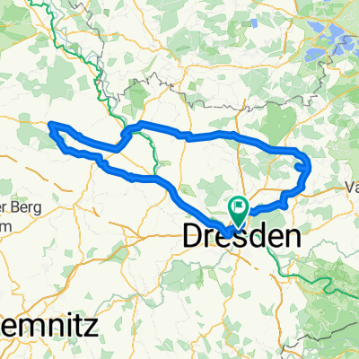
Grundstrasse- Bühlau vor Tankstelle rechts Richtung Gönnsdorf-Schönfeld-Eschdorf (S161)- links halten Richtung Dittersbach-Größröhrsdorff- dort über die Helmsdorferstrasse Richtung Stolpen- Stolpen auf der Stolpner Strasse Richtung Langenwolmsdorf verlassen- auf der S159 Richtung Neustadt i.S.- Neustadt auf der S159 durchqueren Richtung Langburkersdorf- auf der hohen Strasse Richtung Steinigwolmsdorf den Hohwald durchqueren- in Steinigwolmsdorf Richtung Weifa- über Neuschirgiswalde-Schirgiswalde nach Callenberg
- -:--
- Duration
- 58.4 km
- Distance
- 669 m
- Ascent
- 378 m
- Descent
- ---
- Avg. speed
- 499 m
- Max. altitude
Route quality
Waytypes & surfaces along the route
Waytypes
Road
12.3 km
(21 %)
Quiet road
10.5 km
(18 %)
Surfaces
Paved
42.6 km
(73 %)
Unpaved
5.8 km
(10 %)
Asphalt
41.5 km
(71 %)
Gravel
2.9 km
(5 %)
Continue with Bikemap
Use, edit, or download this cycling route
You would like to ride DD-Oberland or customize it for your own trip? Here is what you can do with this Bikemap route:
Free features
- Save this route as favorite or in collections
- Copy & plan your own version of this route
- Sync your route with Garmin or Wahoo
Premium features
Free trial for 3 days, or one-time payment. More about Bikemap Premium.
- Navigate this route on iOS & Android
- Export a GPX / KML file of this route
- Create your custom printout (try it for free)
- Download this route for offline navigation
Discover more Premium features.
Get Bikemap PremiumFrom our community
Other popular routes starting in Dresden
 Schmorsdorfer Höhenrunde
- Distance
- 49.8 km
- Ascent
- 510 m
- Descent
- 488 m
- Location
- Dresden, Saxony, Germany
 DD-Collm-Riesa-Keulenberg-DD
- Distance
- 196.8 km
- Ascent
- 1,000 m
- Descent
- 904 m
- Location
- Dresden, Saxony, Germany
 Strecke - Erdgas Race Day-Speed-Challenge 2009
- Distance
- 63.4 km
- Ascent
- 515 m
- Descent
- 496 m
- Location
- Dresden, Saxony, Germany
 Dresden - Prag
- Distance
- 217.2 km
- Ascent
- 388 m
- Descent
- 303 m
- Location
- Dresden, Saxony, Germany
 Dresden - Glashütte - Bahratal
- Distance
- 90.4 km
- Ascent
- 1,112 m
- Descent
- 1,142 m
- Location
- Dresden, Saxony, Germany
 Pre Velorace Trainingsausfahrt 2015 Einsteiger
- Distance
- 44.6 km
- Ascent
- 222 m
- Descent
- 222 m
- Location
- Dresden, Saxony, Germany
 cielab.org - Dresden - Bahratal - Mückentürmchen
- Distance
- 130 km
- Ascent
- 1,524 m
- Descent
- 1,516 m
- Location
- Dresden, Saxony, Germany
 Rennradrunde um den Tharandter Wald
- Distance
- 78.9 km
- Ascent
- 934 m
- Descent
- 850 m
- Location
- Dresden, Saxony, Germany
Open it in the app