
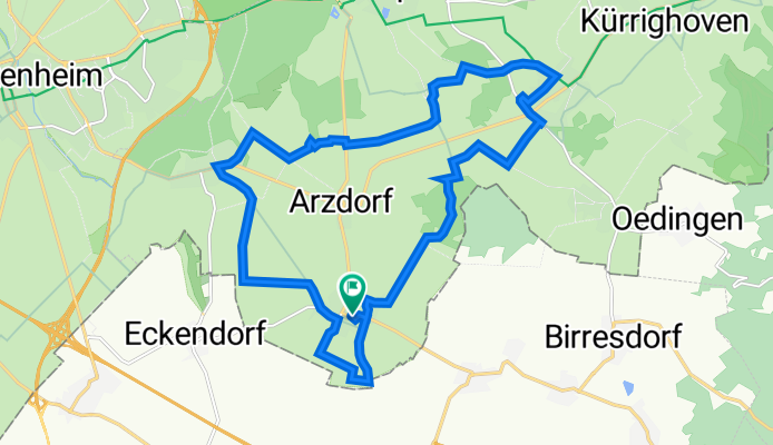
Apfelroute 6 Wachtberg-Schleife
A cycling route starting in Wachtberg, North Rhine-Westphalia, Germany.
Overview
About this route
- 1 h 13 min
- Duration
- 18.9 km
- Distance
- 192 m
- Ascent
- 190 m
- Descent
- 15.5 km/h
- Avg. speed
- 272 m
- Max. altitude

Route quality
Waytypes & surfaces along the route
Waytypes
Track
8.9 km
(47 %)
Quiet road
5.3 km
(28 %)
Surfaces
Paved
15.3 km
(81 %)
Unpaved
2.1 km
(11 %)
Asphalt
14.4 km
(76 %)
Gravel
1.3 km
(7 %)
Continue with Bikemap
Use, edit, or download this cycling route
You would like to ride Apfelroute 6 Wachtberg-Schleife or customize it for your own trip? Here is what you can do with this Bikemap route:
Free features
- Save this route as favorite or in collections
- Copy & plan your own version of this route
- Sync your route with Garmin or Wahoo
Premium features
Free trial for 3 days, or one-time payment. More about Bikemap Premium.
- Navigate this route on iOS & Android
- Export a GPX / KML file of this route
- Create your custom printout (try it for free)
- Download this route for offline navigation
Discover more Premium features.
Get Bikemap PremiumFrom our community
Other popular routes starting in Wachtberg
 Apfelroute 6 Wachtberg-Schleife
- Distance
- 18.9 km
- Ascent
- 192 m
- Descent
- 190 m
- Location
- Wachtberg, North Rhine-Westphalia, Germany
 Waldville 50.8 - 91
- Distance
- 50.9 km
- Ascent
- 173 m
- Descent
- 172 m
- Location
- Wachtberg, North Rhine-Westphalia, Germany
 Landskron
- Distance
- 26 km
- Ascent
- 569 m
- Descent
- 568 m
- Location
- Wachtberg, North Rhine-Westphalia, Germany
 An den Obstgärten 17, Wachtberg nach An den Obstgärten 18, Wachtberg
- Distance
- 55.5 km
- Ascent
- 689 m
- Descent
- 682 m
- Location
- Wachtberg, North Rhine-Westphalia, Germany
 Höchelenacker 3, Wachtberg nach Höchelenacker 3, Wachtberg
- Distance
- 19.5 km
- Ascent
- 47 m
- Descent
- 134 m
- Location
- Wachtberg, North Rhine-Westphalia, Germany
 Fliegendes Dach 33,2 -310 UZ
- Distance
- 33.2 km
- Ascent
- 338 m
- Descent
- 336 m
- Location
- Wachtberg, North Rhine-Westphalia, Germany
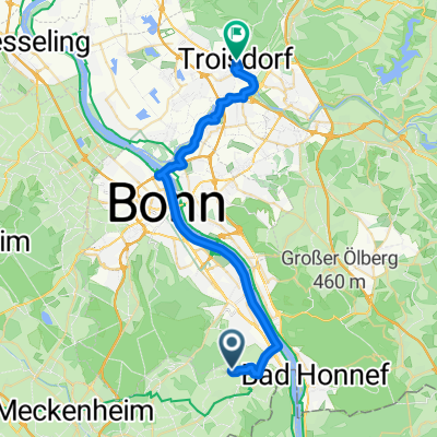 Am Pfirsichhang, Wachtberg nach Hospitalstraße, Troisdorf
- Distance
- 30.6 km
- Ascent
- 102 m
- Descent
- 211 m
- Location
- Wachtberg, North Rhine-Westphalia, Germany
 Eiswerk Rheinbach
- Distance
- 28.1 km
- Ascent
- 122 m
- Descent
- 122 m
- Location
- Wachtberg, North Rhine-Westphalia, Germany
Open it in the app