

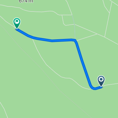
Franken 37, Weißenstadt nach Uferweg, Weißenstadt
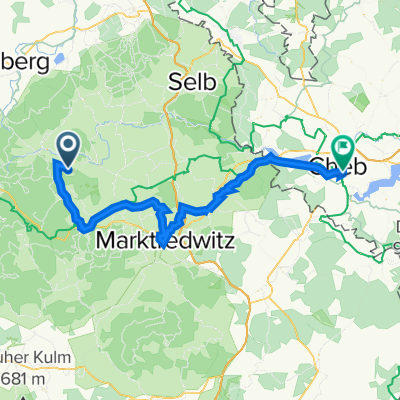
A cycling route starting in Grub, Bavaria, Germany.
Overview
About this route
- 12 min
- Duration
- 3.9 km
- Distance
- 44 m
- Ascent
- 48 m
- Descent
- 20.2 km/h
- Avg. speed
- 626 m
- Max. altitude

Route quality
Waytypes & surfaces along the route
Waytypes
Track
2.4 km
(62 %)
Access road
0.9 km
(23 %)
Surfaces
Paved
1.5 km
(39 %)
Unpaved
2.3 km
(59 %)
Gravel
2.3 km
(59 %)
Asphalt
1.1 km
(29 %)
Continue with Bikemap
Use, edit, or download this cycling route
You would like to ride Franken 37, Weißenstadt nach Uferweg, Weißenstadt or customize it for your own trip? Here is what you can do with this Bikemap route:
Free features
- Save this route as favorite or in collections
- Copy & plan your own version of this route
- Sync your route with Garmin or Wahoo
Premium features
Free trial for 3 days, or one-time payment. More about Bikemap Premium.
- Navigate this route on iOS & Android
- Export a GPX / KML file of this route
- Create your custom printout (try it for free)
- Download this route for offline navigation
Discover more Premium features.
Get Bikemap PremiumFrom our community
Other popular routes starting in Grub
 Weißenstadt nach Forststraße 4, Marktleuthen
- Distance
- 13.8 km
- Ascent
- 214 m
- Descent
- 305 m
- Location
- Grub, Bavaria, Germany
 Röslau Radweg
- Distance
- 58 km
- Ascent
- 288 m
- Descent
- 465 m
- Location
- Grub, Bavaria, Germany
 Kirchenlamitz nach Kirchenlamitz
- Distance
- 1.1 km
- Ascent
- 28 m
- Descent
- 0 m
- Location
- Grub, Bavaria, Germany
 Franken 37, Weißenstadt nach Uferweg, Weißenstadt
- Distance
- 3.9 km
- Ascent
- 44 m
- Descent
- 48 m
- Location
- Grub, Bavaria, Germany
 St2180 10, Weißenstadt nach Campingplatz 3, Weißenstadt
- Distance
- 6.9 km
- Ascent
- 133 m
- Descent
- 122 m
- Location
- Grub, Bavaria, Germany
 Weißenstadt nach Wunsiedler Straße 3, Weißenstadt
- Distance
- 7.2 km
- Ascent
- 749 m
- Descent
- 714 m
- Location
- Grub, Bavaria, Germany
 Weißenstadt nach Franken 37A, Weißenstadt
- Distance
- 3.2 km
- Ascent
- 38 m
- Descent
- 30 m
- Location
- Grub, Bavaria, Germany
Open it in the app