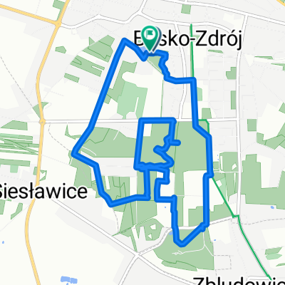
Droga Krajowa 73, Busko-Zdr贸j do Stopnicka 25, Nowy Korczyn
A cycling route starting in Busko-Zdr贸j, 艢wi臋tokrzyskie Voivodship, Poland.
Overview
About this route
- 5 h 37 min
- Duration
- 110 km
- Distance
- 851 m
- Ascent
- 937 m
- Descent
- 19.6 km/h
- Avg. speed
- 267 m
- Avg. speed
Route photos
Route quality
Waytypes & surfaces along the route
Waytypes
Quiet road
41.2 km
(37 %)
Road
23.9 km
(22 %)
Surfaces
Paved
71.9 km
(65 %)
Unpaved
0.7 km
(<1 %)
Asphalt
67.9 km
(62 %)
Paved (undefined)
3 km
(3 %)
Continue with Bikemap
Use, edit, or download this cycling route
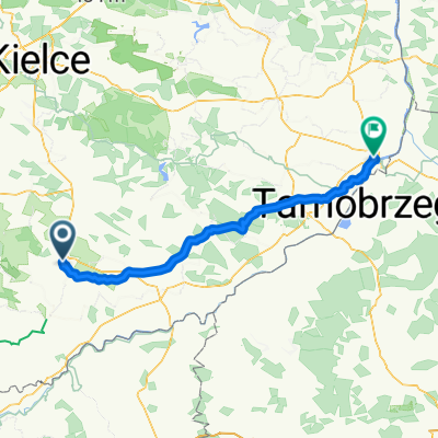
You would like to ride Droga Krajowa 73, Busko-Zdr贸j do Stopnicka 25, Nowy Korczyn or customize it for your own trip? Here is what you can do with this Bikemap route:
Free features
- Save this route as favorite or in collections
- Copy & plan your own version of this route
- Sync your route with Garmin or Wahoo
Premium features
Free trial for 3 days, or one-time payment. More about Bikemap Premium.
- Navigate this route on iOS & Android
- Export a GPX / KML file of this route
- Create your custom printout (try it for free)
- Download this route for offline navigation
Discover more Premium features.
Get Bikemap PremiumFrom our community
Other popular routes starting in Busko-Zdr贸j
- Tadeusza Ko艣ciuszki 30, Busko-Zdr贸j do Tadeusza Ko艣ciuszki 32, Busko-Zdr贸j
- Distance
- 15.6 km
- Ascent
- 103 m
- Descent
- 106 m
- Location
- Busko-Zdr贸j, 艢wi臋tokrzyskie Voivodship, Poland
- Tadeusza Ko艣ciuszki 32, Busko-Zdr贸j do Tadeusza Ko艣ciuszki 32, Busko-Zdr贸j
- Distance
- 15.4 km
- Ascent
- 101 m
- Descent
- 153 m
- Location
- Busko-Zdr贸j, 艢wi臋tokrzyskie Voivodship, Poland
- Tadeusza Ko艣ciuszki 32, Busko-Zdr贸j do Kili艅skiego 17, Busko-Zdr贸j
- Distance
- 21.8 km
- Ascent
- 268 m
- Descent
- 314 m
- Location
- Busko-Zdr贸j, 艢wi臋tokrzyskie Voivodship, Poland
- Busko - Pi艅cz贸w - Wi艣lica
- Distance
- 75.8 km
- Ascent
- 354 m
- Descent
- 355 m
- Location
- Busko-Zdr贸j, 艢wi臋tokrzyskie Voivodship, Poland
- VII TRR, Etap 5 - Busko Zdr贸j - S臋dzisz贸w
- Distance
- 78.7 km
- Ascent
- 247 m
- Descent
- 208 m
- Location
- Busko-Zdr贸j, 艢wi臋tokrzyskie Voivodship, Poland
- 2 dzie艅 BUSKO ZDR脫J - SANDOMIERZ
- Distance
- 94.1 km
- Ascent
- 245 m
- Descent
- 280 m
- Location
- Busko-Zdr贸j, 艢wi臋tokrzyskie Voivodship, Poland
- Kili艅skiega 17, Busko-Zdr贸j do Kili艅skiego 17, Busko-Zdr贸j
- Distance
- 16.3 km
- Ascent
- 85 m
- Descent
- 127 m
- Location
- Busko-Zdr贸j, 艢wi臋tokrzyskie Voivodship, Poland
- Busko - culinary-heritage
- Distance
- 43 km
- Ascent
- 222 m
- Descent
- 221 m
- Location
- Busko-Zdr贸j, 艢wi臋tokrzyskie Voivodship, Poland
Open it in the app