

Wheels to the road (WTTR) - Walnut to 13 Mile Rd loop
A cycling route starting in Wolverine Lake, Michigan, United States.
Overview
About this route
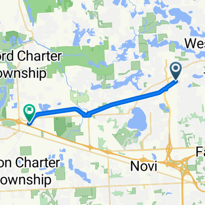
Route designed by West Bloomfield Parks Wheels To The Road bike club for the "Ride Free in 2023" challenge. This is the "13 mile Rd" loop that starts and ends at the Walnut Creek Middle School.
- -:--
- Duration
- 13.1 km
- Distance
- 98 m
- Ascent
- 98 m
- Descent
- ---
- Avg. speed
- 303 m
- Max. altitude
Route quality
Waytypes & surfaces along the route
Waytypes
Cycleway
12.1 km
(92 %)
Access road
0.5 km
(4 %)
Surfaces
Paved
11.4 km
(87 %)
Unpaved
0.8 km
(6 %)
Asphalt
10.8 km
(82 %)
Gravel
0.8 km
(6 %)
Continue with Bikemap
Use, edit, or download this cycling route
You would like to ride Wheels to the road (WTTR) - Walnut to 13 Mile Rd loop or customize it for your own trip? Here is what you can do with this Bikemap route:
Free features
- Save this route as favorite or in collections
- Copy & plan your own version of this route
- Sync your route with Garmin or Wahoo
Premium features
Free trial for 3 days, or one-time payment. More about Bikemap Premium.
- Navigate this route on iOS & Android
- Export a GPX / KML file of this route
- Create your custom printout (try it for free)
- Download this route for offline navigation
Discover more Premium features.
Get Bikemap PremiumFrom our community
Other popular routes starting in Wolverine Lake
 Wheels to the road (WTTR) - Walnut to 13 Mile Rd loop
- Distance
- 13.1 km
- Ascent
- 98 m
- Descent
- 98 m
- Location
- Wolverine Lake, Michigan, United States
 2250 E Oakley Park Rd, Commerce Township to 2135–2153 Haggerty Rd, Commerce Township
- Distance
- 3.3 km
- Ascent
- 8 m
- Descent
- 4 m
- Location
- Wolverine Lake, Michigan, United States
 Wheels to the Road (WTTR) - Walnut Creek Middle School to Arrowhead Rd loop
- Distance
- 8.4 km
- Ascent
- 41 m
- Descent
- 42 m
- Location
- Wolverine Lake, Michigan, United States
 Kassab Lane 3165, Commerce Charter Township to Kassab Lane 3165, Commerce Charter Township
- Distance
- 6.5 km
- Ascent
- 104 m
- Descent
- 103 m
- Location
- Wolverine Lake, Michigan, United States
 Hobart Ct, West Bloomfield to Coe R X R, New Hudson
- Distance
- 15.8 km
- Ascent
- 23 m
- Descent
- 29 m
- Location
- Wolverine Lake, Michigan, United States
 1616 Welch Rd, Commerce Township to 1616 Welch Rd, Commerce Township
- Distance
- 16.1 km
- Ascent
- 26 m
- Descent
- 26 m
- Location
- Wolverine Lake, Michigan, United States
 Recovered Route
- Distance
- 5.2 km
- Ascent
- 47 m
- Descent
- 33 m
- Location
- Wolverine Lake, Michigan, United States
 Circles2Circles
- Distance
- 85 km
- Ascent
- 107 m
- Descent
- 212 m
- Location
- Wolverine Lake, Michigan, United States
Open it in the app