

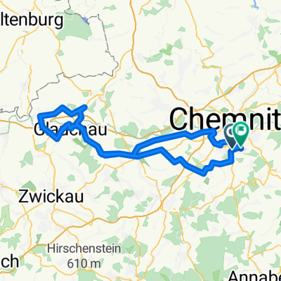
Rundkurs Chemnitz Süd-West
A cycling route starting in Neukirchen, Saxony, Germany.
Overview
About this route
2 Stunden-Strecke mit einzelnen Anstiegen zum Auspowern, aber auch gemütlichen Geradeaus-Abschnitten.
geht durch viel Natur, aber auch durch Stadtgebiete.
Highlights an der Strecke Wasserschloss Klaffenbach, Pelzmühle & Tierpark Chemnitz & wer noch eine Herausforderung Sucht: Aussichtsturm Totenstein (vom Forsthaus Grüna über Schotterpisten noch ungefähr 2 km ordentlich bergauf...)
- -:--
- Duration
- 27 km
- Distance
- 252 m
- Ascent
- 252 m
- Descent
- ---
- Avg. speed
- ---
- Max. altitude
Route quality
Waytypes & surfaces along the route
Waytypes
Busy road
10.1 km
(37 %)
Quiet road
5 km
(19 %)
Surfaces
Paved
22.1 km
(82 %)
Unpaved
2.5 km
(9 %)
Asphalt
18.1 km
(67 %)
Concrete
3 km
(11 %)
Continue with Bikemap
Use, edit, or download this cycling route
You would like to ride Rundkurs Chemnitz Süd-West or customize it for your own trip? Here is what you can do with this Bikemap route:
Free features
- Save this route as favorite or in collections
- Copy & plan your own version of this route
- Sync your route with Garmin or Wahoo
Premium features
Free trial for 3 days, or one-time payment. More about Bikemap Premium.
- Navigate this route on iOS & Android
- Export a GPX / KML file of this route
- Create your custom printout (try it for free)
- Download this route for offline navigation
Discover more Premium features.
Get Bikemap PremiumFrom our community
Other popular routes starting in Neukirchen
 Rundweg Totenstein, entspannt
- Distance
- 24 km
- Ascent
- 273 m
- Descent
- 271 m
- Location
- Neukirchen, Saxony, Germany
 Chemnitz - Südböhmen - Südmähren
- Distance
- 844.3 km
- Ascent
- 2,001 m
- Descent
- 2,130 m
- Location
- Neukirchen, Saxony, Germany
 Chemnitz-Keilberg-Fichtelberg-Chemnitz
- Distance
- 119.9 km
- Ascent
- 1,362 m
- Descent
- 1,362 m
- Location
- Neukirchen, Saxony, Germany
 RR Tour Meerane
- Distance
- 99.6 km
- Ascent
- 423 m
- Descent
- 388 m
- Location
- Neukirchen, Saxony, Germany
 ADFC Feierabend
- Distance
- 27.5 km
- Ascent
- 286 m
- Descent
- 270 m
- Location
- Neukirchen, Saxony, Germany
 Neukirchen - Lugau - Neukirchen
- Distance
- 28.1 km
- Ascent
- 197 m
- Descent
- 193 m
- Location
- Neukirchen, Saxony, Germany
 Lichtenstein über Ursprung
- Distance
- 43 km
- Ascent
- 331 m
- Descent
- 329 m
- Location
- Neukirchen, Saxony, Germany
 Oberwald Hohenstein querdurch
- Distance
- 42.8 km
- Ascent
- 430 m
- Descent
- 433 m
- Location
- Neukirchen, Saxony, Germany
Open it in the app