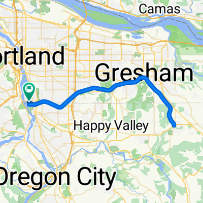
3117 SE Martins St, Portland to 3058 SE Woodstock Blvd, Portland
A cycling route starting in Milwaukie, Oregon, United States.
Overview
About this route
- 1 h 23 min
- Duration
- 18.1 km
- Distance
- 1,318 m
- Ascent
- 1,322 m
- Descent
- 13 km/h
- Avg. speed
- 55 m
- Max. altitude
Route quality
Waytypes & surfaces along the route
Waytypes
Path
5.3 km
(29 %)
Quiet road
4.9 km
(27 %)
Surfaces
Paved
13 km
(72 %)
Paved (undefined)
6.2 km
(34 %)
Asphalt
4.2 km
(23 %)
Continue with Bikemap
Use, edit, or download this cycling route
You would like to ride 3117 SE Martins St, Portland to 3058 SE Woodstock Blvd, Portland or customize it for your own trip? Here is what you can do with this Bikemap route:
Free features
- Save this route as favorite or in collections
- Copy & plan your own version of this route
- Sync your route with Garmin or Wahoo
Premium features
Free trial for 3 days, or one-time payment. More about Bikemap Premium.
- Navigate this route on iOS & Android
- Export a GPX / KML file of this route
- Create your custom printout (try it for free)
- Download this route for offline navigation
Discover more Premium features.
Get Bikemap PremiumFrom our community
Other popular routes starting in Milwaukie
- Butterfly Park and Spring Water Corridor
- Distance
- 18 km
- Ascent
- 244 m
- Descent
- 73 m
- Location
- Milwaukie, Oregon, United States
- loopy loop around the river
- Distance
- 17.9 km
- Ascent
- 106 m
- Descent
- 106 m
- Location
- Milwaukie, Oregon, United States
- Easy ride in Portland
- Distance
- 19.1 km
- Ascent
- 173 m
- Descent
- 123 m
- Location
- Milwaukie, Oregon, United States
- Mciver State Park
- Distance
- 56.5 km
- Ascent
- 606 m
- Descent
- 497 m
- Location
- Milwaukie, Oregon, United States
- Route to 5675 SE International Way, Portland
- Distance
- 9.7 km
- Ascent
- 0 m
- Descent
- 8 m
- Location
- Milwaukie, Oregon, United States
- 3117 SE Martins St, Portland to 3058 SE Woodstock Blvd, Portland
- Distance
- 18.1 km
- Ascent
- 1,318 m
- Descent
- 1,322 m
- Location
- Milwaukie, Oregon, United States
- Bike, Brew, and Chew Circuit
- Distance
- 25.7 km
- Ascent
- 189 m
- Descent
- 189 m
- Location
- Milwaukie, Oregon, United States
- Long way to Council Crest
- Distance
- 37.5 km
- Ascent
- 687 m
- Descent
- 650 m
- Location
- Milwaukie, Oregon, United States
Open it in the app