
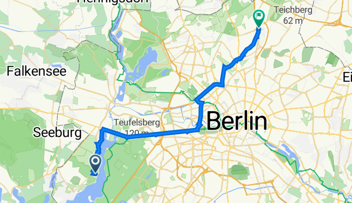
Hochwaldsteig 22, Berlin to Hauptstraße 48, Berlin
A cycling route starting in Gatow, Land Berlin, Germany.
Overview
About this route
- 2 h 9 min
- Duration
- 31.2 km
- Distance
- 131 m
- Ascent
- 139 m
- Descent
- 14.5 km/h
- Avg. speed
- 71 m
- Max. altitude

Route quality
Waytypes & surfaces along the route
Waytypes
Cycleway
13.9 km
(44 %)
Quiet road
6.5 km
(21 %)
Surfaces
Paved
30.9 km
(99 %)
Asphalt
23.6 km
(76 %)
Paving stones
6.7 km
(21 %)
Continue with Bikemap
Use, edit, or download this cycling route
You would like to ride Hochwaldsteig 22, Berlin to Hauptstraße 48, Berlin or customize it for your own trip? Here is what you can do with this Bikemap route:
Free features
- Save this route as favorite or in collections
- Copy & plan your own version of this route
- Sync your route with Garmin or Wahoo
Premium features
Free trial for 3 days, or one-time payment. More about Bikemap Premium.
- Navigate this route on iOS & Android
- Export a GPX / KML file of this route
- Create your custom printout (try it for free)
- Download this route for offline navigation
Discover more Premium features.
Get Bikemap PremiumFrom our community
Other popular routes starting in Gatow
 Langsame Fahrt in Berlin
- Distance
- 7.7 km
- Ascent
- 32 m
- Descent
- 26 m
- Location
- Gatow, Land Berlin, Germany
 Wald. Berlin. Klima.
- Distance
- 3.4 km
- Ascent
- 51 m
- Descent
- 53 m
- Location
- Gatow, Land Berlin, Germany
 Ferdinand-Magellan-Straße, Berlin nach Breitehornweg 28–36, Berlin
- Distance
- 348.2 km
- Ascent
- 58 m
- Descent
- 66 m
- Location
- Gatow, Land Berlin, Germany
 Grunewald Runde 25
- Distance
- 26.8 km
- Ascent
- 168 m
- Descent
- 171 m
- Location
- Gatow, Land Berlin, Germany
 Jaqui Geburtstag
- Distance
- 15.3 km
- Ascent
- 71 m
- Descent
- 69 m
- Location
- Gatow, Land Berlin, Germany
 Hochwaldsteig 22, Berlin to Hauptstraße 25, Berlin
- Distance
- 26.4 km
- Ascent
- 137 m
- Descent
- 149 m
- Location
- Gatow, Land Berlin, Germany
 Hagelberg2
- Distance
- 122 km
- Ascent
- 451 m
- Descent
- 438 m
- Location
- Gatow, Land Berlin, Germany
 Trainingsrunde
- Distance
- 45.6 km
- Ascent
- 240 m
- Descent
- 238 m
- Location
- Gatow, Land Berlin, Germany
Open it in the app