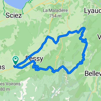
Toor de France Stage 14-17
A cycling route starting in Bons-en-Chablais, Auvergne-Rh么ne-Alpes, France.
Overview
About this route
- -:--
- Duration
- 286 km
- Distance
- 24,463 m
- Ascent
- 23,289 m
- Descent
- ---
- Avg. speed
- 2,559 m
- Max. altitude
Route highlights
Points of interest along the route
Point of interest after 66.9 km
Ziel Stage 14
Point of interest after 79.5 km
Start Stage 15
Point of interest after 105.2 km
Start 14. Stage
Point of interest after 125.4 km
123
Point of interest after 187.5 km
Ziel Stage 15 Start Stage17
Point of interest after 191.1 km
Start Stage 16
Point of interest after 200 km
Ziel Stage 16
Continue with Bikemap
Use, edit, or download this cycling route
You would like to ride Toor de France Stage 14-17 or customize it for your own trip? Here is what you can do with this Bikemap route:
Free features
- Save this route as favorite or in collections
- Copy & plan your own version of this route
- Split it into stages to create a multi-day tour
- Sync your route with Garmin or Wahoo
Premium features
Free trial for 3 days, or one-time payment. More about Bikemap Premium.
- Navigate this route on iOS & Android
- Export a GPX / KML file of this route
- Create your custom printout (try it for free)
- Download this route for offline navigation
Discover more Premium features.
Get Bikemap PremiumFrom our community
Other popular routes starting in Bons-en-Chablais
- Supersaxel-T锚te du Char-Col de Cou
- Distance
- 7.4 km
- Ascent
- 292 m
- Descent
- 298 m
- Location
- Bons-en-Chablais, Auvergne-Rh么ne-Alpes, France
- test
- Distance
- 14.7 km
- Ascent
- 790 m
- Descent
- 19 m
- Location
- Bons-en-Chablais, Auvergne-Rh么ne-Alpes, France
- Toor de France Stage 14-17
- Distance
- 286 km
- Ascent
- 24,463 m
- Descent
- 23,289 m
- Location
- Bons-en-Chablais, Auvergne-Rh么ne-Alpes, France
- BikeComputer Training Session
- Distance
- 54.8 km
- Ascent
- 1,337 m
- Descent
- 1,782 m
- Location
- Bons-en-Chablais, Auvergne-Rh么ne-Alpes, France
- frontaliers
- Distance
- 37.9 km
- Ascent
- 280 m
- Descent
- 290 m
- Location
- Bons-en-Chablais, Auvergne-Rh么ne-Alpes, France
- Vall茅e Verte 10 Col Challenge
- Distance
- 80.2 km
- Ascent
- 1,811 m
- Descent
- 1,814 m
- Location
- Bons-en-Chablais, Auvergne-Rh么ne-Alpes, France
- bas chablais
- Distance
- 33.1 km
- Ascent
- 220 m
- Descent
- 324 m
- Location
- Bons-en-Chablais, Auvergne-Rh么ne-Alpes, France
- Grimp茅e des Voirons 2022
- Distance
- 14.9 km
- Ascent
- 836 m
- Descent
- 19 m
- Location
- Bons-en-Chablais, Auvergne-Rh么ne-Alpes, France
Open it in the app