

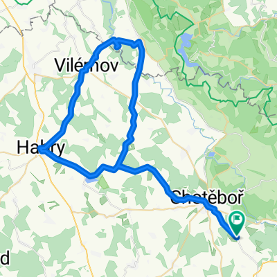
Chotěboř - Lichnice- Lipnice nad Sázavou Chotěboř
A cycling route starting in Chotěboř, Kraj Vysočina, Czechia.
Overview
About this route
Route with two prominent peaks at the medieval castles Lichnice in the Iron Mountains and Lipnice nad Sázavou.
- -:--
- Duration
- 101 km
- Distance
- 843 m
- Ascent
- 840 m
- Descent
- ---
- Avg. speed
- ---
- Max. altitude
Route quality
Waytypes & surfaces along the route
Waytypes
Road
61.6 km
(61 %)
Quiet road
5.1 km
(5 %)
Surfaces
Paved
54.6 km
(54 %)
Asphalt
52.5 km
(52 %)
Paved (undefined)
2 km
(2 %)
Undefined
46.5 km
(46 %)
Continue with Bikemap
Use, edit, or download this cycling route
You would like to ride Chotěboř - Lichnice- Lipnice nad Sázavou Chotěboř or customize it for your own trip? Here is what you can do with this Bikemap route:
Free features
- Save this route as favorite or in collections
- Copy & plan your own version of this route
- Split it into stages to create a multi-day tour
- Sync your route with Garmin or Wahoo
Premium features
Free trial for 3 days, or one-time payment. More about Bikemap Premium.
- Navigate this route on iOS & Android
- Export a GPX / KML file of this route
- Create your custom printout (try it for free)
- Download this route for offline navigation
Discover more Premium features.
Get Bikemap PremiumFrom our community
Other popular routes starting in Chotěboř
 Školní výlet 2
- Distance
- 21.8 km
- Ascent
- 283 m
- Descent
- 265 m
- Location
- Chotěboř, Kraj Vysočina, Czechia
 Corosscountry without any climb
- Distance
- 21.9 km
- Ascent
- 241 m
- Descent
- 241 m
- Location
- Chotěboř, Kraj Vysočina, Czechia
 OKOLO LIBICE 2015
- Distance
- 27.2 km
- Ascent
- 426 m
- Descent
- 425 m
- Location
- Chotěboř, Kraj Vysočina, Czechia
 Libice - Bajkove uterky
- Distance
- 42 km
- Ascent
- 466 m
- Descent
- 466 m
- Location
- Chotěboř, Kraj Vysočina, Czechia
 Ride to the Iron Mountains
- Distance
- 44.1 km
- Ascent
- 502 m
- Descent
- 503 m
- Location
- Chotěboř, Kraj Vysočina, Czechia
 Výlet Chotěboř - pařížovská přehrada a zpět
- Distance
- 59.9 km
- Ascent
- 417 m
- Descent
- 417 m
- Location
- Chotěboř, Kraj Vysočina, Czechia
 Jarní výlet údolím pod Železnýma horama
- Distance
- 26.7 km
- Ascent
- 292 m
- Descent
- 290 m
- Location
- Chotěboř, Kraj Vysočina, Czechia
 2015_11 Údolí Doubravy pěšky
- Distance
- 11.2 km
- Ascent
- 169 m
- Descent
- 172 m
- Location
- Chotěboř, Kraj Vysočina, Czechia
Open it in the app