

lehká trasa Obora - Velké Opatovice a zpět
A cycling route starting in Doubravice nad Svitavou, South Moravian, Czechia.
Overview
About this route
A relatively flat route, exceptionally almost the same both ways. Again entirely on roads.
- -:--
- Duration
- 49.5 km
- Distance
- 551 m
- Ascent
- 545 m
- Descent
- ---
- Avg. speed
- 438 m
- Max. altitude
Route quality
Waytypes & surfaces along the route
Waytypes
Road
19.8 km
(40 %)
Quiet road
0.5 km
(1 %)
Undefined
29.2 km
(59 %)
Surfaces
Paved
22.8 km
(46 %)
Asphalt
22.8 km
(46 %)
Undefined
26.7 km
(54 %)
Continue with Bikemap
Use, edit, or download this cycling route
You would like to ride lehká trasa Obora - Velké Opatovice a zpět or customize it for your own trip? Here is what you can do with this Bikemap route:
Free features
- Save this route as favorite or in collections
- Copy & plan your own version of this route
- Sync your route with Garmin or Wahoo
Premium features
Free trial for 3 days, or one-time payment. More about Bikemap Premium.
- Navigate this route on iOS & Android
- Export a GPX / KML file of this route
- Create your custom printout (try it for free)
- Download this route for offline navigation
Discover more Premium features.
Get Bikemap PremiumFrom our community
Other popular routes starting in Doubravice nad Svitavou
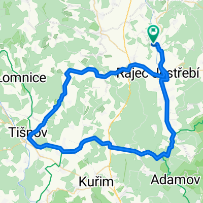 ČH - Tišnov - BK
- Distance
- 61.2 km
- Ascent
- 491 m
- Descent
- 490 m
- Location
- Doubravice nad Svitavou, South Moravian, Czechia
 lehká zkrácená trasa v okolí Obory
- Distance
- 18.6 km
- Ascent
- 185 m
- Descent
- 215 m
- Location
- Doubravice nad Svitavou, South Moravian, Czechia
 lehká trasa Obora - Velké Opatovice a zpět
- Distance
- 49.5 km
- Ascent
- 551 m
- Descent
- 545 m
- Location
- Doubravice nad Svitavou, South Moravian, Czechia
 Doubravice n.S. - Boskovice - Jaroměřice - Loštice
- Distance
- 50.4 km
- Ascent
- 641 m
- Descent
- 662 m
- Location
- Doubravice nad Svitavou, South Moravian, Czechia
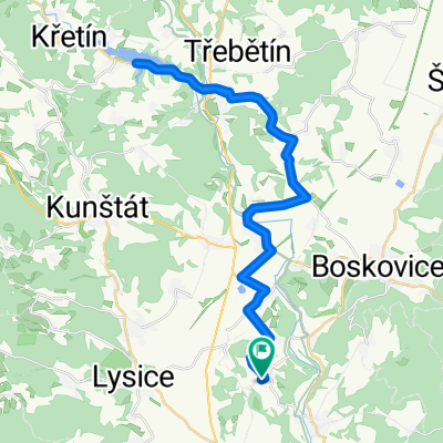 lehká projížďka na Křetinku
- Distance
- 42.7 km
- Ascent
- 607 m
- Descent
- 636 m
- Location
- Doubravice nad Svitavou, South Moravian, Czechia
 nenáročná trasa Obora - Sloup - Valchov - Boskovice - Obora
- Distance
- 35 km
- Ascent
- 672 m
- Descent
- 692 m
- Location
- Doubravice nad Svitavou, South Moravian, Czechia
 lehká odpočinková trasa v okolí Obory
- Distance
- 22.3 km
- Ascent
- 159 m
- Descent
- 226 m
- Location
- Doubravice nad Svitavou, South Moravian, Czechia
 nenáročná trasa Obora - Chudčice - Blansko - Obora
- Distance
- 83.9 km
- Ascent
- 1,177 m
- Descent
- 1,281 m
- Location
- Doubravice nad Svitavou, South Moravian, Czechia
Open it in the app