

Bayerwald Tag 2: Großer Osser / Um den Hohenbogen
A cycling route starting in Neukirchen, Bavaria, Germany.
Overview
About this route
The Great Osser is not suitable for crossing with a mountain bike, as it requires carrying it, and on days with many hikers, it can get cramped in the summit area.
- -:--
- Duration
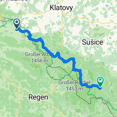
- 75.4 km
- Distance
- 1,248 m
- Ascent
- 1,248 m
- Descent
- ---
- Avg. speed
- ---
- Max. altitude
Continue with Bikemap
Use, edit, or download this cycling route
You would like to ride Bayerwald Tag 2: Großer Osser / Um den Hohenbogen or customize it for your own trip? Here is what you can do with this Bikemap route:
Free features
- Save this route as favorite or in collections
- Copy & plan your own version of this route
- Sync your route with Garmin or Wahoo
Premium features
Free trial for 3 days, or one-time payment. More about Bikemap Premium.
- Navigate this route on iOS & Android
- Export a GPX / KML file of this route
- Create your custom printout (try it for free)
- Download this route for offline navigation
Discover more Premium features.
Get Bikemap PremiumFrom our community
Other popular routes starting in Neukirchen
 Bayerwald Tag 2: Großer Osser / Um den Hohenbogen
- Distance
- 75.4 km
- Ascent
- 1,248 m
- Descent
- 1,248 m
- Location
- Neukirchen, Bavaria, Germany
 GT2-6 Neukirchen-Waidhaus
- Distance
- 97.4 km
- Ascent
- 1,751 m
- Descent
- 1,650 m
- Location
- Neukirchen, Bavaria, Germany
 20160518_092432.gpx
- Distance
- 38.7 km
- Ascent
- 690 m
- Descent
- 693 m
- Location
- Neukirchen, Bavaria, Germany
 Große Arber Runde
- Distance
- 115.5 km
- Ascent
- 1,558 m
- Descent
- 1,558 m
- Location
- Neukirchen, Bavaria, Germany
 Hinterbuchberger Straße, Eschlkam nach Kvilda, Kvilda
- Distance
- 82.2 km
- Ascent
- 2,201 m
- Descent
- 1,598 m
- Location
- Neukirchen, Bavaria, Germany
 Hoher-Bogen-Weg 1, Neukirchen beim Heiligen Blut nach Meisenweg 3–7, Cham
- Distance
- 30.7 km
- Ascent
- 143 m
- Descent
- 738 m
- Location
- Neukirchen, Bavaria, Germany
 Neukirchen Hotel Donna W Seilbahn
- Distance
- 11.9 km
- Ascent
- 645 m
- Descent
- 478 m
- Location
- Neukirchen, Bavaria, Germany
 Nk02 Wander Freibachweg)
- Distance
- 7.7 km
- Ascent
- 610 m
- Descent
- 610 m
- Location
- Neukirchen, Bavaria, Germany
Open it in the app