

Sudety (11)
A cycling route starting in Javorník, Olomoucký kraj, Czechia.
Overview
About this route
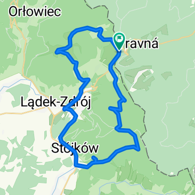
The trip provided many unforgettable aesthetic experiences, but one exhausting climb had to be overcome between Wójtówka and the Lądek Pass. The local routes are little frequented, which in the 1980s caused the WOP officers to become lazy, and the route of the solidarity couriers ran through here.
- -:--
- Duration
- 25.8 km
- Distance
- 657 m
- Ascent
- 657 m
- Descent
- ---
- Avg. speed
- ---
- Max. altitude

Continue with Bikemap
Use, edit, or download this cycling route
You would like to ride Sudety (11) or customize it for your own trip? Here is what you can do with this Bikemap route:
Free features
- Save this route as favorite or in collections
- Copy & plan your own version of this route
- Sync your route with Garmin or Wahoo
Premium features
Free trial for 3 days, or one-time payment. More about Bikemap Premium.
- Navigate this route on iOS & Android
- Export a GPX / KML file of this route
- Create your custom printout (try it for free)
- Download this route for offline navigation
Discover more Premium features.
Get Bikemap PremiumFrom our community
Other popular routes starting in Javorník
 Sudety (11)
- Distance
- 25.8 km
- Ascent
- 657 m
- Descent
- 657 m
- Location
- Javorník, Olomoucký kraj, Czechia
 Objezd ČR V.
- Distance
- 171.5 km
- Ascent
- 2,484 m
- Descent
- 2,412 m
- Location
- Javorník, Olomoucký kraj, Czechia
 Javorník-Smrk-Jindřichov
- Distance
- 58.6 km
- Ascent
- 1,239 m
- Descent
- 1,044 m
- Location
- Javorník, Olomoucký kraj, Czechia
 Javorník - Ladek Zdrój
- Distance
- 16.6 km
- Ascent
- 421 m
- Descent
- 263 m
- Location
- Javorník, Olomoucký kraj, Czechia
 Lut-Bor-Jaw-Rad-Lad
- Distance
- 29.5 km
- Ascent
- 616 m
- Descent
- 824 m
- Location
- Javorník, Olomoucký kraj, Czechia
 Okolo Česka D05
- Distance
- 37 km
- Ascent
- 763 m
- Descent
- 362 m
- Location
- Javorník, Olomoucký kraj, Czechia
 Travna-Bila voda -Zlaty Stok -Bily potok - Javornik -Travna
- Distance
- 39.5 km
- Ascent
- 608 m
- Descent
- 608 m
- Location
- Javorník, Olomoucký kraj, Czechia
 Javornik - Holba
- Distance
- 61.3 km
- Ascent
- 1,496 m
- Descent
- 1,397 m
- Location
- Javorník, Olomoucký kraj, Czechia
Open it in the app