
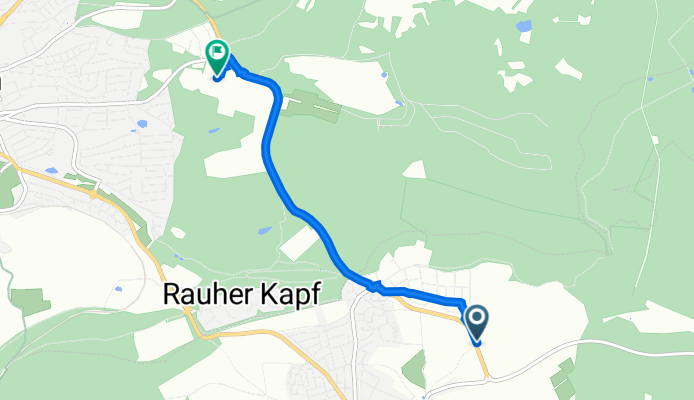
K 1057, Schönaich to Hennenbühl, Böblingen
A cycling route starting in Schönaich, Baden-Württemberg, Germany.
Overview
About this route
- 17 min
- Duration
- 4.1 km
- Distance
- 69 m
- Ascent
- 6 m
- Descent
- 14.2 km/h
- Avg. speed
- 516 m
- Avg. speed
Route quality
Waytypes & surfaces along the route
Waytypes
Path
1.9 km
(46 %)
Cycleway
0.8 km
(20 %)
Surfaces
Paved
3.4 km
(85 %)
Asphalt
3.3 km
(81 %)
Paving stones
0.1 km
(3 %)
Undefined
0.6 km
(15 %)
Continue with Bikemap
Use, edit, or download this cycling route
You would like to ride K 1057, Schönaich to Hennenbühl, Böblingen or customize it for your own trip? Here is what you can do with this Bikemap route:
Free features
- Save this route as favorite or in collections
- Copy & plan your own version of this route
- Sync your route with Garmin or Wahoo
Premium features
Free trial for 3 days, or one-time payment. More about Bikemap Premium.
- Navigate this route on iOS & Android
- Export a GPX / KML file of this route
- Create your custom printout (try it for free)
- Download this route for offline navigation
Discover more Premium features.
Get Bikemap PremiumFrom our community
Other popular routes starting in Schönaich
 Von Schönaich bis Weil im Schönbuch
- Distance
- 9.8 km
- Ascent
- 213 m
- Descent
- 174 m
- Location
- Schönaich, Baden-Württemberg, Germany
 Centennial Bike Tour 100 Jahre IBM - 100 IBMer - 100 km
- Distance
- 100 km
- Ascent
- 624 m
- Descent
- 681 m
- Location
- Schönaich, Baden-Württemberg, Germany
 Recording from 07 Apr 2016 18:38
- Distance
- 10.9 km
- Ascent
- 159 m
- Descent
- 111 m
- Location
- Schönaich, Baden-Württemberg, Germany
 Rundfahrt - Flughafen - Siebenmühlental - Waldenbuch - Schönaich
- Distance
- 33.9 km
- Ascent
- 322 m
- Descent
- 323 m
- Location
- Schönaich, Baden-Württemberg, Germany
 Schönaich zur Weiler Hütte
- Distance
- 7.8 km
- Ascent
- 140 m
- Descent
- 60 m
- Location
- Schönaich, Baden-Württemberg, Germany
 Schönaicher Runde
- Distance
- 8.6 km
- Ascent
- 125 m
- Descent
- 125 m
- Location
- Schönaich, Baden-Württemberg, Germany
 Schönaich - Musberg - Waldtour
- Distance
- 18.9 km
- Ascent
- 340 m
- Descent
- 341 m
- Location
- Schönaich, Baden-Württemberg, Germany
 IBM Junirunde
- Distance
- 54.8 km
- Ascent
- 436 m
- Descent
- 436 m
- Location
- Schönaich, Baden-Württemberg, Germany
Open it in the app