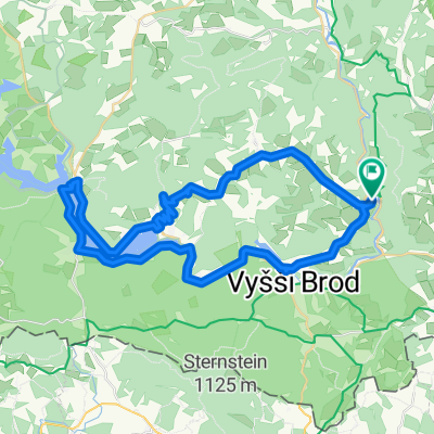
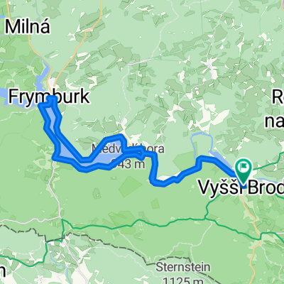
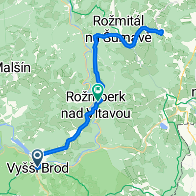
Lipnói tó
A cycling route starting in Vyšší Brod, Jihočeský kraj, Czechia.
Overview
About this route
null
- -:--
- Duration
- 73.2 km
- Distance
- 823 m
- Ascent
- 810 m
- Descent
- ---
- Avg. speed
- 1,018 m
- Max. altitude
Route quality
Waytypes & surfaces along the route
Waytypes
Cycleway
16.8 km
(23 %)
Track
16.1 km
(22 %)
Surfaces
Paved
46.1 km
(63 %)
Unpaved
10.2 km
(14 %)
Asphalt
41.7 km
(57 %)
Gravel
5.1 km
(7 %)
Continue with Bikemap
Use, edit, or download this cycling route
You would like to ride Lipnói tó or customize it for your own trip? Here is what you can do with this Bikemap route:
Free features
- Save this route as favorite or in collections
- Copy & plan your own version of this route
- Sync your route with Garmin or Wahoo
Premium features
Free trial for 3 days, or one-time payment. More about Bikemap Premium.
- Navigate this route on iOS & Android
- Export a GPX / KML file of this route
- Create your custom printout (try it for free)
- Download this route for offline navigation
Discover more Premium features.
Get Bikemap PremiumFrom our community
Other popular routes starting in Vyšší Brod
- Radsprotten Tour 2019: Bohemian Rhapsody
- Distance
- 321.7 km
- Ascent
- 1,469 m
- Descent
- 1,452 m
- Location
- Vyšší Brod, Jihočeský kraj, Czechia
- Rožmberk nad Vltavou - Vyšší Brod (9 km)
- Distance
- 8.6 km
- Ascent
- 147 m
- Descent
- 134 m
- Location
- Vyšší Brod, Jihočeský kraj, Czechia
- Šumavská magistrála
- Distance
- 197.4 km
- Ascent
- 3,406 m
- Descent
- 3,535 m
- Location
- Vyšší Brod, Jihočeský kraj, Czechia
- Vyšší Brod-Innsbruck-Benátky(1.část)
- Distance
- 439.8 km
- Ascent
- 707 m
- Descent
- 692 m
- Location
- Vyšší Brod, Jihočeský kraj, Czechia
- 2023. Cseh túra 2. nap 1 alternatíva Tibivel
- Distance
- 48.6 km
- Ascent
- 688 m
- Descent
- 750 m
- Location
- Vyšší Brod, Jihočeský kraj, Czechia
- Radtour2013/2
- Distance
- 91.9 km
- Ascent
- 943 m
- Descent
- 876 m
- Location
- Vyšší Brod, Jihočeský kraj, Czechia
- 20.7.-Vyšší Brod-Rozmberg-Rozmital-Cesky kr.-Zlatá Koruna 4:09hod-11,4km/hod-58,9max
- Distance
- 48 km
- Ascent
- 1,043 m
- Descent
- 1,148 m
- Location
- Vyšší Brod, Jihočeský kraj, Czechia
- ViššyGrad_Praha
- Distance
- 486.5 km
- Ascent
- 1,632 m
- Descent
- 1,988 m
- Location
- Vyšší Brod, Jihočeský kraj, Czechia
Open it in the app