

Da Birds and Da Bees
A cycling route starting in De Pere, Wisconsin, United States.
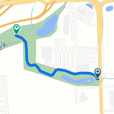
Overview
About this route
A bumbling bicycle ride bridging the East River Trail and the Baird Creek Trail. Parking lots at both ends of the route.
- -:--
- Duration
- 19 km
- Distance
- 66 m
- Ascent
- 45 m
- Descent
- ---
- Avg. speed
- 202 m
- Max. altitude

Route quality
Waytypes & surfaces along the route
Waytypes
Path
11.6 km
(61 %)
Pedestrian area
6.1 km
(32 %)
Surfaces
Paved
8 km
(42 %)
Unpaved
2.4 km
(13 %)
Asphalt
7.9 km
(41 %)
Unpaved (undefined)
2.4 km
(13 %)
Route highlights
Points of interest along the route
Drinking water after 0.5 km
Water/Bathrooms
Drinking water after 6.5 km
Water/Bathrooms
Continue with Bikemap
Use, edit, or download this cycling route
You would like to ride Da Birds and Da Bees or customize it for your own trip? Here is what you can do with this Bikemap route:
Free features
- Save this route as favorite or in collections
- Copy & plan your own version of this route
- Sync your route with Garmin or Wahoo
Premium features
Free trial for 3 days, or one-time payment. More about Bikemap Premium.
- Navigate this route on iOS & Android
- Export a GPX / KML file of this route
- Create your custom printout (try it for free)
- Download this route for offline navigation
Discover more Premium features.
Get Bikemap PremiumFrom our community
Other popular routes starting in De Pere
 Silent3
- Distance
- 20.2 km
- Ascent
- 29 m
- Descent
- 29 m
- Location
- De Pere, Wisconsin, United States
 1278 S Seventh St, De Pere to 525 Main St, Wrightstown
- Distance
- 16.1 km
- Ascent
- 52 m
- Descent
- 39 m
- Location
- De Pere, Wisconsin, United States
 American Boulevard - Matthew Drive
- Distance
- 0.9 km
- Ascent
- 4 m
- Descent
- 4 m
- Location
- De Pere, Wisconsin, United States
 2881 S Broadway, Ashwaubenon to 391 Whispering Creek Ct, Howard
- Distance
- 13.3 km
- Ascent
- 33 m
- Descent
- 35 m
- Location
- De Pere, Wisconsin, United States
 Dairy Queen boat launch
- Distance
- 8.8 km
- Ascent
- 16 m
- Descent
- 20 m
- Location
- De Pere, Wisconsin, United States
 Recovered Route
- Distance
- 36 km
- Ascent
- 242 m
- Descent
- 218 m
- Location
- De Pere, Wisconsin, United States
 Da Birds and Da Bees
- Distance
- 19 km
- Ascent
- 66 m
- Descent
- 45 m
- Location
- De Pere, Wisconsin, United States
 De Pere Preserve Trail (paved section)
- Distance
- 0.6 km
- Ascent
- 4 m
- Descent
- 4 m
- Location
- De Pere, Wisconsin, United States
Open it in the app