

Tour 3 Löwenstein
A cycling route starting in Welzheim, Baden-Wurttemberg, Germany.
Overview
About this route
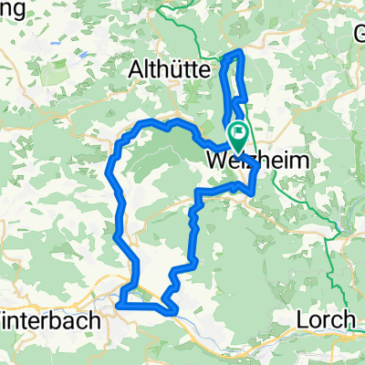
Welzheim-Althütte-Ittenberg-Sulzbach-Spiegelberg-Jux-Nassach-Löwenstein-Reisach-Scheppach-Unterheimbach-Maienfels-Brettach-Mainhardt-Hütten-Wielandsweiler-Kirchenkirnberg-Kaisersbach-Welzheim
- -:--
- Duration
- 111.3 km
- Distance
- 1,666 m
- Ascent
- 1,653 m
- Descent
- ---
- Avg. speed
- 528 m
- Max. altitude

Route quality
Waytypes & surfaces along the route
Waytypes
Road
27.8 km
(25 %)
Quiet road
23.4 km
(21 %)
Surfaces
Paved
92.4 km
(83 %)
Unpaved
2.2 km
(2 %)
Asphalt
88 km
(79 %)
Paved (undefined)
4.5 km
(4 %)
Continue with Bikemap
Use, edit, or download this cycling route
You would like to ride Tour 3 Löwenstein or customize it for your own trip? Here is what you can do with this Bikemap route:
Free features
- Save this route as favorite or in collections
- Copy & plan your own version of this route
- Split it into stages to create a multi-day tour
- Sync your route with Garmin or Wahoo
Premium features
Free trial for 3 days, or one-time payment. More about Bikemap Premium.
- Navigate this route on iOS & Android
- Export a GPX / KML file of this route
- Create your custom printout (try it for free)
- Download this route for offline navigation
Discover more Premium features.
Get Bikemap PremiumFrom our community
Other popular routes starting in Welzheim
 rund um Welzheim (incl. Ebnisee/Kastell)
- Distance
- 36.6 km
- Ascent
- 482 m
- Descent
- 482 m
- Location
- Welzheim, Baden-Wurttemberg, Germany
 Tour 7 Schwäb. Fränkischer Wald
- Distance
- 152 km
- Ascent
- 2,704 m
- Descent
- 2,781 m
- Location
- Welzheim, Baden-Wurttemberg, Germany
 Welzheim - Günzburg
- Distance
- 117.5 km
- Ascent
- 633 m
- Descent
- 670 m
- Location
- Welzheim, Baden-Wurttemberg, Germany
 rund um Welzheim (incl. Ebnisee/Kastell)
- Distance
- 36.7 km
- Ascent
- 532 m
- Descent
- 523 m
- Location
- Welzheim, Baden-Wurttemberg, Germany
 Wieslauftal-Runde
- Distance
- 49.1 km
- Ascent
- 425 m
- Descent
- 422 m
- Location
- Welzheim, Baden-Wurttemberg, Germany
 Tour 2 Waldenburg
- Distance
- 161.7 km
- Ascent
- 1,390 m
- Descent
- 1,451 m
- Location
- Welzheim, Baden-Wurttemberg, Germany
 Welzheim - Kaisersbach - Aichstrut - Höldis - Eisenbachstausee - Rienharz - Welzheim
- Distance
- 27.1 km
- Ascent
- 208 m
- Descent
- 211 m
- Location
- Welzheim, Baden-Wurttemberg, Germany
 Welzheim-Schwarzwald 1.Tag
- Distance
- 146.5 km
- Ascent
- 1,287 m
- Descent
- 1,268 m
- Location
- Welzheim, Baden-Wurttemberg, Germany
Open it in the app