

Tour südlich vom Genfersee
A cycling route starting in Troistorrents, Valais, Switzerland.
Overview
About this route
Anstrengende Mehrpässetour südlich vom Genfersee.
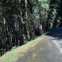
Bis auf den Anstieg auf den Pas de Morgins und kürzere Abschnitte in vor Abondance, beim Lac du Jotty, nach Bons-en-Chblais und vor Genf verläuft die Route auf eher wenig befahrenen Nebenstrassen.
- -:--
- Duration
- 103.9 km
- Distance
- 1,588 m
- Ascent
- 1,961 m
- Descent
- ---
- Avg. speed
- ---
- Max. altitude

Route quality
Waytypes & surfaces along the route
Waytypes
Road
47.2 km
(45 %)
Busy road
38.7 km
(37 %)
Surfaces
Paved
70.7 km
(68 %)
Unpaved
0.1 km
(<1 %)
Asphalt
70 km
(67 %)
Concrete
0.7 km
(<1 %)
Continue with Bikemap
Use, edit, or download this cycling route
You would like to ride Tour südlich vom Genfersee or customize it for your own trip? Here is what you can do with this Bikemap route:
Free features
- Save this route as favorite or in collections
- Copy & plan your own version of this route
- Split it into stages to create a multi-day tour
- Sync your route with Garmin or Wahoo
Premium features
Free trial for 3 days, or one-time payment. More about Bikemap Premium.
- Navigate this route on iOS & Android
- Export a GPX / KML file of this route
- Create your custom printout (try it for free)
- Download this route for offline navigation
Discover more Premium features.
Get Bikemap PremiumFrom our community
Other popular routes starting in Troistorrents
 Wallis Alpine Bike Etape 02
- Distance
- 49.4 km
- Ascent
- 2,611 m
- Descent
- 2,848 m
- Location
- Troistorrents, Valais, Switzerland
 Alpine Tour: Chatel - Gruyère
- Distance
- 96.7 km
- Ascent
- 1,446 m
- Descent
- 1,895 m
- Location
- Troistorrents, Valais, Switzerland
 Tour südlich vom Genfersee
- Distance
- 103.9 km
- Ascent
- 1,588 m
- Descent
- 1,961 m
- Location
- Troistorrents, Valais, Switzerland
 Chatel Tour
- Distance
- 26.4 km
- Ascent
- 1,384 m
- Descent
- 1,381 m
- Location
- Troistorrents, Valais, Switzerland
 Chatel ouest - Abondance - Joux verte - Lindaret
- Distance
- 64.2 km
- Ascent
- 2,834 m
- Descent
- 2,835 m
- Location
- Troistorrents, Valais, Switzerland
 Chemin de Vai l'Otau, Troistorrents à Chemin de Vai l'Otau, Troistorrents
- Distance
- 32.1 km
- Ascent
- 1,105 m
- Descent
- 1,104 m
- Location
- Troistorrents, Valais, Switzerland
 Route de Chenarlier 23, Troistorrents à Chemin de Vai l'Otau 4, Troistorrents
- Distance
- 41.7 km
- Ascent
- 2,732 m
- Descent
- 2,718 m
- Location
- Troistorrents, Valais, Switzerland
 Chatel - Tour Mont de Grange
- Distance
- 35.5 km
- Ascent
- 1,013 m
- Descent
- 1,011 m
- Location
- Troistorrents, Valais, Switzerland
Open it in the app