Tuerlersee_Triemli
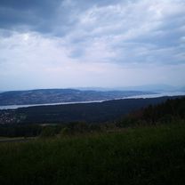
A cycling route starting in Mühlehalde, Canton of Zurich, Switzerland.
Overview
About this route
- -:--
- Duration
- 18.9 km
- Distance
- 219 m
- Ascent
- 411 m
- Descent
- ---
- Avg. speed
- 666 m
- Avg. speed
Route quality
Waytypes & surfaces along the route
Waytypes
Path
5.9 km
(31 %)
Quiet road
4.1 km
(22 %)
Surfaces
Paved
16.5 km
(87 %)
Unpaved
1.7 km
(9 %)
Asphalt
16.4 km
(87 %)
Gravel
1.5 km
(8 %)
Continue with Bikemap
Use, edit, or download this cycling route
You would like to ride Tuerlersee_Triemli or customize it for your own trip? Here is what you can do with this Bikemap route:
Free features
- Save this route as favorite or in collections
- Copy & plan your own version of this route
- Sync your route with Garmin or Wahoo
Premium features
Free trial for 3 days, or one-time payment. More about Bikemap Premium.
- Navigate this route on iOS & Android
- Export a GPX / KML file of this route
- Create your custom printout (try it for free)
- Download this route for offline navigation
Discover more Premium features.
Get Bikemap PremiumFrom our community
Other popular routes starting in Mühlehalde
- Albis
- Distance
- 18.3 km
- Ascent
- 490 m
- Descent
- 503 m
- Location
- Mühlehalde, Canton of Zurich, Switzerland
- muster
- Distance
- 3.9 km
- Ascent
- 35 m
- Descent
- 167 m
- Location
- Mühlehalde, Canton of Zurich, Switzerland
- Langnau Sihlsprung
- Distance
- 45.1 km
- Ascent
- 669 m
- Descent
- 669 m
- Location
- Mühlehalde, Canton of Zurich, Switzerland
- 2016 Aemtlerweg ab Mühlau nach Mägenwil
- Distance
- 64.1 km
- Ascent
- 224 m
- Descent
- 458 m
- Location
- Mühlehalde, Canton of Zurich, Switzerland
- 6 Tag Türlersee - Bahnhof Zug
- Distance
- 14.6 km
- Ascent
- 31 m
- Descent
- 266 m
- Location
- Mühlehalde, Canton of Zurich, Switzerland
- Türlen 13, Hausen am Albis nach Bachstrasse 33, Birmensdorf
- Distance
- 29.6 km
- Ascent
- 300 m
- Descent
- 474 m
- Location
- Mühlehalde, Canton of Zurich, Switzerland
- Hansueli
- Distance
- 312.5 km
- Ascent
- 3,561 m
- Descent
- 4,010 m
- Location
- Mühlehalde, Canton of Zurich, Switzerland
- Hinteralbisstrasse 14, Langnau am Albis nach Rue de l'Église 14, Claudon
- Distance
- 310.7 km
- Ascent
- 3,509 m
- Descent
- 3,967 m
- Location
- Mühlehalde, Canton of Zurich, Switzerland
Open it in the app