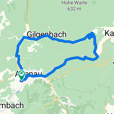
Hohe Warthe 9.10.2011

A cycling route starting in 
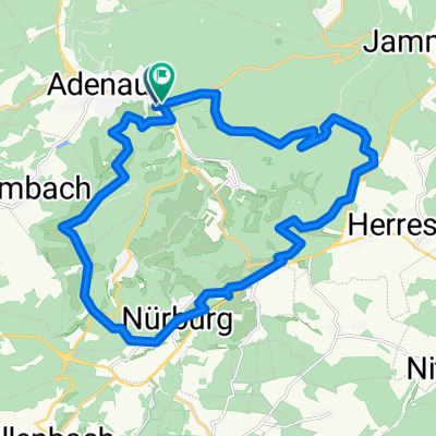
Adenau, Rhineland-Palatinate, Germany.

Overview

About this route

0

Ausgangs- und Ende-Punkt Parkplatz Voba in Adenau am Nürburgring. Über den "Kreuzweg" geht es zur "Lasso-Hütte" hoch, dann über die "Gleich" Richtung Hohe Acht durch herrrliche Natur mit weitem Blick auf den Höhen, schmale Pfade in dichtem Mischwald, steile Anstiege, rasante Abfahrten, Erholungsphasen auf der Höhe,

Weiterfahrt auf der "Hohen Warthe" für die Profis über die "Teufelsley" Richtung Weinberge oberhalb des Ahrtals" bis Ahrweiler.


Zeit geht etwas schneller, musste mich nach 4. Knie-OP zurückhalten.


Viel Spaß !

-:--
Duration
21.5 km
Distance
554 m
Ascent
544 m
Descent
---
Avg. speed
---
Avg. speed
toonsxxl
toonsxxl

created this 13 years ago

Route quality

Waytypes & surfaces along the route

Route highlights

Points of interest along the route

  1. Highlight 1 along the Bikemap route "Hohe Warthe 9.10.2011"

    Point of interest after 0.4 km

    Begin des Kreuzwegs

  2. Highlight 2 along the Bikemap route "Hohe Warthe 9.10.2011"

    Point of interest after 2 km

    Lasso Hütte

  3. Highlight 3 along the Bikemap route "Hohe Warthe 9.10.2011"

    Point of interest after 4 km

    Natur Pur

  4. Highlight 4 along the Bikemap route "Hohe Warthe 9.10.2011"

    Point of interest after 4.8 km

    Kleine Ruhepause

  5. Highlight 5 along the Bikemap route "Hohe Warthe 9.10.2011"

    Point of interest after 7.1 km

    Blick ins Tal -

  6. Highlight 6 along the Bikemap route "Hohe Warthe 9.10.2011"

    Point of interest after 7.5 km

    Herbstimpressionen Laubwald

  7. Highlight 7 along the Bikemap route "Hohe Warthe 9.10.2011"

    Point of interest after 8.5 km

    Hier steht die Zeit still -

  8. Highlight 8 along the Bikemap route "Hohe Warthe 9.10.2011"

    Point of interest after 9.7 km

    Mallek Höfe mit Ferienwohnungen

  9. Highlight 9 along the Bikemap route "Hohe Warthe 9.10.2011"

    Point of interest after 9.8 km

  10. Highlight 10 along the Bikemap route "Hohe Warthe 9.10.2011"

    Point of interest after 10 km

    Bilderstock

  11. Highlight 11 along the Bikemap route "Hohe Warthe 9.10.2011"

    Point of interest after 12.7 km

    Vorfreude auf die Vesperpause -

  12. Highlight 12 along the Bikemap route "Hohe Warthe 9.10.2011"

    Point of interest after 12.7 km

    Bitte keinen Abfall zurücklassen -

  13. Highlight 13 along the Bikemap route "Hohe Warthe 9.10.2011"

    Point of interest after 12.8 km

    und abwärtz gehts -

  14. Point of interest after 13.5 km

    Weiter geradeaus geht es über die Höhen Richtung Ahrweiler über den bekannten "Karl-Kaufmann-Weg" -

  15. Highlight 15 along the Bikemap route "Hohe Warthe 9.10.2011"

    Point of interest after 17.6 km

    Der tiefste Teil der Runde ist erreicht an der B 247 bei Leimbach -

  16. Highlight 16 along the Bikemap route "Hohe Warthe 9.10.2011"

    Point of interest after 18.1 km

    Fahrradweg mit Brücke über Adenauer Bach Richtung Adenau -

Continue with Bikemap

Use, edit, or download this cycling route

You would like to ride Hohe Warthe 9.10.2011 or customize it for your own trip? Here is what you can do with this Bikemap route:

Free features

Premium features

Free trial for 3 days, or one-time payment. More about Bikemap Premium.

  • Navigate this route on iOS & Android
  • Export a GPX / KML file of this route
  • Create your custom printout (try it for free)
  • Download this route for offline navigation

Discover more Premium features.

Get Bikemap Premium

From our community

Other popular routes starting in Adenau