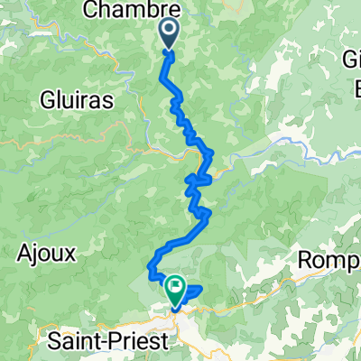
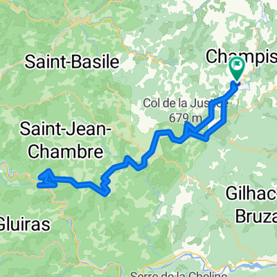
CHATEAU DE CACHARD
A cycling route starting in Vernoux-en-Vivarais, Auvergne-Rh么ne-Alpes, France.
Overview
About this route
- -:--
- Duration
- 34.4 km
- Distance
- 632 m
- Ascent
- 625 m
- Descent
- ---
- Avg. speed
- 759 m
- Avg. speed
Route quality
Waytypes & surfaces along the route
Waytypes
Road
16.2 km
(47 %)
Busy road
15.5 km
(45 %)
Surfaces
Paved
5.4 km
(16 %)
Unpaved
0.4 km
(1 %)
Asphalt
5.4 km
(16 %)
Gravel
0.4 km
(1 %)
Undefined
28.6 km
(83 %)
Continue with Bikemap
Use, edit, or download this cycling route
You would like to ride CHATEAU DE CACHARD or customize it for your own trip? Here is what you can do with this Bikemap route:
Free features
- Save this route as favorite or in collections
- Copy & plan your own version of this route
- Sync your route with Garmin or Wahoo
Premium features
Free trial for 3 days, or one-time payment. More about Bikemap Premium.
- Navigate this route on iOS & Android
- Export a GPX / KML file of this route
- Create your custom printout (try it for free)
- Download this route for offline navigation
Discover more Premium features.
Get Bikemap PremiumFrom our community
Other popular routes starting in Vernoux-en-Vivarais
- serre de mur
- Distance
- 7.6 km
- Ascent
- 47 m
- Descent
- 674 m
- Location
- Vernoux-en-Vivarais, Auvergne-Rh么ne-Alpes, France
- anniv tony retour 1
- Distance
- 29.5 km
- Ascent
- 274 m
- Descent
- 729 m
- Location
- Vernoux-en-Vivarais, Auvergne-Rh么ne-Alpes, France
- Retour_Dimanche
- Distance
- 10.4 km
- Ascent
- 71 m
- Descent
- 462 m
- Location
- Vernoux-en-Vivarais, Auvergne-Rh么ne-Alpes, France
- Untitled route
- Distance
- 60.8 km
- Ascent
- 3,118 m
- Descent
- 2,527 m
- Location
- Vernoux-en-Vivarais, Auvergne-Rh么ne-Alpes, France
- vernoux5
- Distance
- 79.3 km
- Ascent
- 920 m
- Descent
- 920 m
- Location
- Vernoux-en-Vivarais, Auvergne-Rh么ne-Alpes, France
- Saint-Cierge-sous-le-Cheylard alte Eisenb.
- Distance
- 101.3 km
- Ascent
- 2,147 m
- Descent
- 2,147 m
- Location
- Vernoux-en-Vivarais, Auvergne-Rh么ne-Alpes, France
- vernoux1
- Distance
- 40.4 km
- Ascent
- 643 m
- Descent
- 640 m
- Location
- Vernoux-en-Vivarais, Auvergne-Rh么ne-Alpes, France
- 脌 L么o quoi
- Distance
- 573.1 km
- Ascent
- 1,861 m
- Descent
- 1,975 m
- Location
- Vernoux-en-Vivarais, Auvergne-Rh么ne-Alpes, France
Open it in the app