Vichy - Vic le Comte
A cycling route starting in Abrest, Auvergne-Rh么ne-Alpes, France.
Overview
About this route
Camping La Font de Bleix Chemin des Roches, 63730 Les Martres-de-Veyre
- -:--
- Duration
- 72.8 km
- Distance
- 552 m
- Ascent
- 474 m
- Descent
- ---
- Avg. speed
- 578 m
- Avg. speed
Route quality
Waytypes & surfaces along the route
Waytypes
Road
42.9 km
(59 %)
Busy road
18.2 km
(25 %)
Surfaces
Paved
62.2 km
(86 %)
Unpaved
1.9 km
(3 %)
Asphalt
62.2 km
(86 %)
Gravel
1.1 km
(1 %)
Continue with Bikemap
Use, edit, or download this cycling route
You would like to ride Vichy - Vic le Comte or customize it for your own trip? Here is what you can do with this Bikemap route:
Free features
- Save this route as favorite or in collections
- Copy & plan your own version of this route
- Sync your route with Garmin or Wahoo
Premium features
Free trial for 3 days, or one-time payment. More about Bikemap Premium.
- Navigate this route on iOS & Android
- Export a GPX / KML file of this route
- Create your custom printout (try it for free)
- Download this route for offline navigation
Discover more Premium features.
Get Bikemap PremiumFrom our community
Other popular routes starting in Abrest
- D906E 166, Abrest do Avenue de Vichy 149, Abrest
- Distance
- 42.1 km
- Ascent
- 342 m
- Descent
- 348 m
- Location
- Abrest, Auvergne-Rh么ne-Alpes, France
- Vichy Loop
- Distance
- 35.8 km
- Ascent
- 596 m
- Descent
- 594 m
- Location
- Abrest, Auvergne-Rh么ne-Alpes, France
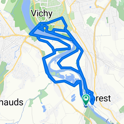
- D426 11, Abrest do D906E 166, Abrest
- Distance
- 29.6 km
- Ascent
- 271 m
- Descent
- 246 m
- Location
- Abrest, Auvergne-Rh么ne-Alpes, France
- Abrest Cycling
- Distance
- 3.7 km
- Ascent
- 40 m
- Descent
- 73 m
- Location
- Abrest, Auvergne-Rh么ne-Alpes, France
- Vichy - Vic le Comte
- Distance
- 72.8 km
- Ascent
- 552 m
- Descent
- 474 m
- Location
- Abrest, Auvergne-Rh么ne-Alpes, France
- 2013-15: Vichy > Belleville (160 km)
- Distance
- 159.8 km
- Ascent
- 1,875 m
- Descent
- 1,757 m
- Location
- Abrest, Auvergne-Rh么ne-Alpes, France
- Vichy-Dorat
- Distance
- 34.3 km
- Ascent
- 157 m
- Descent
- 124 m
- Location
- Abrest, Auvergne-Rh么ne-Alpes, France
- rondje centraal massief
- Distance
- 1,060.7 km
- Ascent
- 3,392 m
- Descent
- 3,392 m
- Location
- Abrest, Auvergne-Rh么ne-Alpes, France
Open it in the app