

Kircheller Heide
A cycling route starting in Oberhausen, North Rhine-Westphalia, Germany.
Overview
About this route
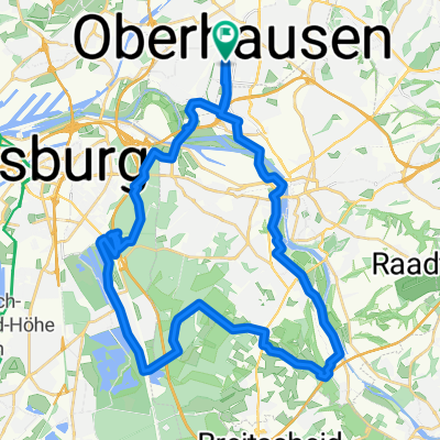
Über die Jacobi-Trasse an der Hanielhalde vorbei in das Waldgebiet Kircheller Heide. Vom Flugplatz Schwarze Heide geht es über Hünxer und Bruckhauser Wald durch den Hiesfelder Wald. Man merkt, eine schöne waldreiche Strecke. Wieder an der Hanielhalde vorbei, geht es über den Köllnischen Wald in Bottrop zurück nach Oberhausen zu unserem Startpunkt. Die Srrecke führt den größten Teil über Radwanderwege. Die wenigen Straßen die befahren werden müssen, sind durchweg verkehrsarm.
- -:--
- Duration
- 53.3 km
- Distance
- 333 m
- Ascent
- 333 m
- Descent
- ---
- Avg. speed
- 78 m
- Max. altitude

Route quality
Waytypes & surfaces along the route
Waytypes
Track
21.9 km
(41 %)
Path
14.9 km
(28 %)
Surfaces
Paved
17.6 km
(33 %)
Unpaved
25.1 km
(47 %)
Gravel
21.3 km
(40 %)
Asphalt
16 km
(30 %)
Continue with Bikemap
Use, edit, or download this cycling route
You would like to ride Kircheller Heide or customize it for your own trip? Here is what you can do with this Bikemap route:
Free features
- Save this route as favorite or in collections
- Copy & plan your own version of this route
- Sync your route with Garmin or Wahoo
Premium features
Free trial for 3 days, or one-time payment. More about Bikemap Premium.
- Navigate this route on iOS & Android
- Export a GPX / KML file of this route
- Create your custom printout (try it for free)
- Download this route for offline navigation
Discover more Premium features.
Get Bikemap PremiumFrom our community
Other popular routes starting in Oberhausen
 Centro, Rotbach, Voerde, Walsum, Centro
- Distance
- 54 km
- Ascent
- 159 m
- Descent
- 167 m
- Location
- Oberhausen, North Rhine-Westphalia, Germany
 Sonntags-Tour1_OB_MH_Baldeneysee_MH_OB
- Distance
- 59.7 km
- Ascent
- 258 m
- Descent
- 263 m
- Location
- Oberhausen, North Rhine-Westphalia, Germany
 OB.Osterfeld-Essen Ketwig
- Distance
- 19.4 km
- Ascent
- 68 m
- Descent
- 60 m
- Location
- Oberhausen, North Rhine-Westphalia, Germany
 Kleine Runde um die Ruhr OB/DU/MH
- Distance
- 21.1 km
- Ascent
- 44 m
- Descent
- 42 m
- Location
- Oberhausen, North Rhine-Westphalia, Germany
 24 Haldentour vier Halden im Revier
- Distance
- 55.8 km
- Ascent
- 294 m
- Descent
- 294 m
- Location
- Oberhausen, North Rhine-Westphalia, Germany
 schöne Feierabendrunde
- Distance
- 37.4 km
- Ascent
- 200 m
- Descent
- 200 m
- Location
- Oberhausen, North Rhine-Westphalia, Germany
 Olga - Gahlen - Drevenack - Wesel - Orsoy
- Distance
- 88 km
- Ascent
- 144 m
- Descent
- 145 m
- Location
- Oberhausen, North Rhine-Westphalia, Germany
 HOAG-Trasse - Kleine Emscher
- Distance
- 40.1 km
- Ascent
- 96 m
- Descent
- 96 m
- Location
- Oberhausen, North Rhine-Westphalia, Germany
Open it in the app