
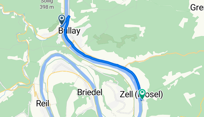
Auf Kockert 18, Alf nach Balduinstraße 42, Zell (Mosel)
A cycling route starting in Bullay, Rhineland-Palatinate, Germany.
Overview
About this route
- 26 min
- Duration
- 6.8 km
- Distance
- 25 m
- Ascent
- 80 m
- Descent
- 16 km/h
- Avg. speed
- 155 m
- Max. altitude

Route quality
Waytypes & surfaces along the route
Waytypes
Path
4.2 km
(62 %)
Access road
1.4 km
(20 %)
Surfaces
Paved
2.2 km
(33 %)
Asphalt
2.2 km
(33 %)
Undefined
4.6 km
(67 %)
Continue with Bikemap
Use, edit, or download this cycling route
You would like to ride Auf Kockert 18, Alf nach Balduinstraße 42, Zell (Mosel) or customize it for your own trip? Here is what you can do with this Bikemap route:
Free features
- Save this route as favorite or in collections
- Copy & plan your own version of this route
- Sync your route with Garmin or Wahoo
Premium features
Free trial for 3 days, or one-time payment. More about Bikemap Premium.
- Navigate this route on iOS & Android
- Export a GPX / KML file of this route
- Create your custom printout (try it for free)
- Download this route for offline navigation
Discover more Premium features.
Get Bikemap PremiumFrom our community
Other popular routes starting in Bullay
 B1 Bullay main street circuit (Germany)
- Distance
- 2.3 km
- Ascent
- 12 m
- Descent
- 13 m
- Location
- Bullay, Rhineland-Palatinate, Germany
 Am Bläderborn 6, Bullay nach Kaiserstraße 11, Reil
- Distance
- 7.9 km
- Ascent
- 106 m
- Descent
- 114 m
- Location
- Bullay, Rhineland-Palatinate, Germany
 Alf zu Onkel Toms Hütte über Moselsteig nach Neef und zurück nach Alf
- Distance
- 17.6 km
- Ascent
- 844 m
- Descent
- 849 m
- Location
- Bullay, Rhineland-Palatinate, Germany
 40 Mosel1
- Distance
- 33.8 km
- Ascent
- 104 m
- Descent
- 136 m
- Location
- Bullay, Rhineland-Palatinate, Germany
 Kirchstraße 11, Bullay to Moselpromenade 17–27, Cochem
- Distance
- 34.8 km
- Ascent
- 2,328 m
- Descent
- 2,347 m
- Location
- Bullay, Rhineland-Palatinate, Germany
 M7 Bullay to Treis-Karden (Germany)
- Distance
- 45 km
- Ascent
- 342 m
- Descent
- 354 m
- Location
- Bullay, Rhineland-Palatinate, Germany
 Mosel 46km 650hm
- Distance
- 46.2 km
- Ascent
- 617 m
- Descent
- 613 m
- Location
- Bullay, Rhineland-Palatinate, Germany
 Moderate route in Cochem
- Distance
- 22.3 km
- Ascent
- 128 m
- Descent
- 95 m
- Location
- Bullay, Rhineland-Palatinate, Germany
Open it in the app