

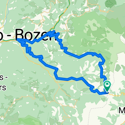
Soraga - Rif.Gardeccia - Val San Nicolò
A cycling route starting in Soraga, Trentino-Alto Adige, Italy.
Overview
About this route
Soraga - Rif. Gardeccia - Val San Nicolò
- -:--
- Duration
- 43.9 km
- Distance
- 1,524 m
- Ascent
- 1,524 m
- Descent
- ---
- Avg. speed
- 1,978 m
- Max. altitude

Route quality
Waytypes & surfaces along the route
Waytypes
Quiet road
18 km
(41 %)
Cycleway
8.8 km
(20 %)
Surfaces
Paved
27.2 km
(62 %)
Unpaved
5.7 km
(13 %)
Asphalt
27.2 km
(62 %)
Loose gravel
3.5 km
(8 %)
Continue with Bikemap
Use, edit, or download this cycling route
You would like to ride Soraga - Rif.Gardeccia - Val San Nicolò or customize it for your own trip? Here is what you can do with this Bikemap route:
Free features
- Save this route as favorite or in collections
- Copy & plan your own version of this route
- Sync your route with Garmin or Wahoo
Premium features
Free trial for 3 days, or one-time payment. More about Bikemap Premium.
- Navigate this route on iOS & Android
- Export a GPX / KML file of this route
- Create your custom printout (try it for free)
- Download this route for offline navigation
Discover more Premium features.
Get Bikemap PremiumFrom our community
Other popular routes starting in Soraga
 S. Pellegrino - Fedai
- Distance
- 87.3 km
- Ascent
- 2,035 m
- Descent
- 2,037 m
- Location
- Soraga, Trentino-Alto Adige, Italy
 T2020-E5
- Distance
- 140.3 km
- Ascent
- 2,709 m
- Descent
- 3,781 m
- Location
- Soraga, Trentino-Alto Adige, Italy
 DOLOMITI 3
- Distance
- 61 km
- Ascent
- 1,748 m
- Descent
- 1,747 m
- Location
- Soraga, Trentino-Alto Adige, Italy
 Costalunga-Merano-Costalunga
- Distance
- 150.5 km
- Ascent
- 3,379 m
- Descent
- 4,172 m
- Location
- Soraga, Trentino-Alto Adige, Italy
 Soraga - Rif.Gardeccia - Val San Nicolò
- Distance
- 43.9 km
- Ascent
- 1,524 m
- Descent
- 1,524 m
- Location
- Soraga, Trentino-Alto Adige, Italy
 Karerpass-Nigerpass-Welschnofen-Karersee
- Distance
- 69.8 km
- Ascent
- 1,833 m
- Descent
- 1,833 m
- Location
- Soraga, Trentino-Alto Adige, Italy
 Karerp-Seis
- Distance
- 31.1 km
- Ascent
- 529 m
- Descent
- 1,295 m
- Location
- Soraga, Trentino-Alto Adige, Italy
 Da Carezza a Moena
- Distance
- 8.1 km
- Ascent
- 258 m
- Descent
- 835 m
- Location
- Soraga, Trentino-Alto Adige, Italy
Open it in the app