

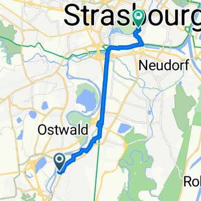
De Rue des Vignes, Illkirch-Graffenstaden à Striegel 3, Erstein
A cycling route starting in Illkirch-Graffenstaden, Grand Est, France.
Overview
About this route
- 2 h 50 min
- Duration
- 31.5 km
- Distance
- 20 m
- Ascent
- 61 m
- Descent
- 11.1 km/h
- Avg. speed
- 195 m
- Max. altitude

Route quality
Waytypes & surfaces along the route
Waytypes
Path
15.4 km
(49 %)
Cycleway
12 km
(38 %)
Surfaces
Paved
29.9 km
(95 %)
Asphalt
28.4 km
(90 %)
Concrete
0.9 km
(3 %)
Continue with Bikemap
Use, edit, or download this cycling route
You would like to ride De Rue des Vignes, Illkirch-Graffenstaden à Striegel 3, Erstein or customize it for your own trip? Here is what you can do with this Bikemap route:
Free features
- Save this route as favorite or in collections
- Copy & plan your own version of this route
- Sync your route with Garmin or Wahoo
Premium features
Free trial for 3 days, or one-time payment. More about Bikemap Premium.
- Navigate this route on iOS & Android
- Export a GPX / KML file of this route
- Create your custom printout (try it for free)
- Download this route for offline navigation
Discover more Premium features.
Get Bikemap PremiumFrom our community
Other popular routes starting in Illkirch-Graffenstaden
 2009 Euro Tour -- Ride Day 36 — 4 August 2009 — 67118 Geispolsheim (Strasbourg) to 76227 Karlsruhe
- Distance
- 123.5 km
- Ascent
- 81 m
- Descent
- 111 m
- Location
- Illkirch-Graffenstaden, Grand Est, France
 Illkirch-Graffenstaden à 4–6 Rue du Bain aux Roses, Strasbourg
- Distance
- 8.9 km
- Ascent
- 48 m
- Descent
- 49 m
- Location
- Illkirch-Graffenstaden, Grand Est, France
 Illkirch-Graffenstaden - Basel
- Distance
- 123.4 km
- Ascent
- 155 m
- Descent
- 48 m
- Location
- Illkirch-Graffenstaden, Grand Est, France
 18–20 Route du Rhin, Illkirch-Graffenstaden à Rue Baudelaire, Lipsheim
- Distance
- 10.8 km
- Ascent
- 27 m
- Descent
- 24 m
- Location
- Illkirch-Graffenstaden, Grand Est, France
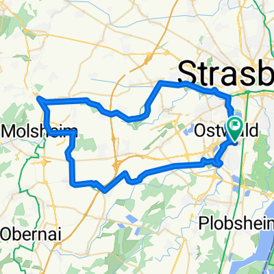 Illkirch-Canal de la Bruche-Molsheim
- Distance
- 54.1 km
- Ascent
- 75 m
- Descent
- 77 m
- Location
- Illkirch-Graffenstaden, Grand Est, France
 Illkirch-Graffenstaden - Niderviller
- Distance
- 81.5 km
- Ascent
- 622 m
- Descent
- 503 m
- Location
- Illkirch-Graffenstaden, Grand Est, France
 1 Rue du Fort, Geispolsheim à 4 Rue de la Porte-Basse, Geispolsheim
- Distance
- 3.7 km
- Ascent
- 9 m
- Descent
- 3 m
- Location
- Illkirch-Graffenstaden, Grand Est, France
 De Rue des Vignes, Illkirch-Graffenstaden à Striegel 3, Erstein
- Distance
- 31.5 km
- Ascent
- 20 m
- Descent
- 61 m
- Location
- Illkirch-Graffenstaden, Grand Est, France
Open it in the app