

Bad Godesberg-Altenahr
A cycling route starting in Königswinter, North Rhine-Westphalia, Germany.
Overview
About this route
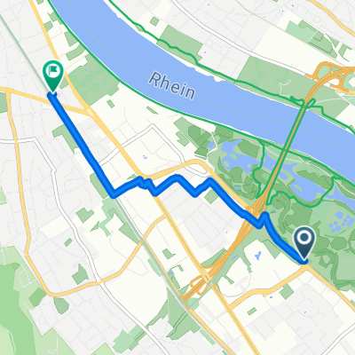
Beautiful road bike route (circuit) from Bonn Bad Godesberg to Altenahr and back again.
The starting point is Schweinheim (Bad Godesberg). You directly ride uphill towards the Waldkrankenhaus. Once you reach an elevation of about 300 meters, there's a beautiful stretch through the forest to the Kottenforst train station.
From the station, you head towards Altenahr. There is a lovely spot along the Ahr that invites you to linger, and if the weather allows, the cyclist can also enjoy a cooling dip in the Ahr. After this lovely break, you continue directly onto the loop towards Mayschoß.
Particularly in October, this region comes alive with the activities of the harvest. Wine festivals take place everywhere, and the last grapes are being harvested. Gorgeous apples hang from the trees, greeting the cyclist. This is how one experiences the final kilometers of this - in my opinion - wonderful tour.
After about three hours of pure riding time, the road cyclist returns to the starting point of the tour.
Caution: A small section of the route (500m) is not paved! But that shouldn't be a problem.
- -:--
- Duration
- 71.6 km
- Distance
- 579 m
- Ascent
- 589 m
- Descent
- ---
- Avg. speed
- ---
- Max. altitude
Route quality
Waytypes & surfaces along the route
Waytypes
Track
15 km
(21 %)
Road
13.6 km
(19 %)
Surfaces
Paved
60.9 km
(85 %)
Unpaved
2.9 km
(4 %)
Asphalt
60.9 km
(85 %)
Gravel
2.1 km
(3 %)
Continue with Bikemap
Use, edit, or download this cycling route
You would like to ride Bad Godesberg-Altenahr or customize it for your own trip? Here is what you can do with this Bikemap route:
Free features
- Save this route as favorite or in collections
- Copy & plan your own version of this route
- Sync your route with Garmin or Wahoo
Premium features
Free trial for 3 days, or one-time payment. More about Bikemap Premium.
- Navigate this route on iOS & Android
- Export a GPX / KML file of this route
- Create your custom printout (try it for free)
- Download this route for offline navigation
Discover more Premium features.
Get Bikemap PremiumFrom our community
Other popular routes starting in Königswinter
 Bonn Triathlon Radstrecke CLONED FROM ROUTE 808814
- Distance
- 58.6 km
- Ascent
- 596 m
- Descent
- 596 m
- Location
- Königswinter, North Rhine-Westphalia, Germany
 Siebengebirge Süd
- Distance
- 44 km
- Ascent
- 546 m
- Descent
- 539 m
- Location
- Königswinter, North Rhine-Westphalia, Germany
 MTB Tour Königswinter
- Distance
- 33.2 km
- Ascent
- 975 m
- Descent
- 975 m
- Location
- Königswinter, North Rhine-Westphalia, Germany
 Route nach Bonn
- Distance
- 3.9 km
- Ascent
- 16 m
- Descent
- 10 m
- Location
- Königswinter, North Rhine-Westphalia, Germany
 mahagonis Abschlußrunde 30.9.07 ca.60 km!
- Distance
- 50.4 km
- Ascent
- 299 m
- Descent
- 300 m
- Location
- Königswinter, North Rhine-Westphalia, Germany
 Oberkassel - Königswinter - Petersberg - Ittenbach - Stieldorf - Hangelar - Beuel
- Distance
- 39 km
- Ascent
- 525 m
- Descent
- 524 m
- Location
- Königswinter, North Rhine-Westphalia, Germany
 Singletrailtour Siebengebirge
- Distance
- 33.4 km
- Ascent
- 1,070 m
- Descent
- 1,070 m
- Location
- Königswinter, North Rhine-Westphalia, Germany
 Ahrweiler Tour
- Distance
- 41.8 km
- Ascent
- 514 m
- Descent
- 513 m
- Location
- Königswinter, North Rhine-Westphalia, Germany
Open it in the app